MyTopo
Percilla Texas US Topo Map
Couldn't load pickup availability
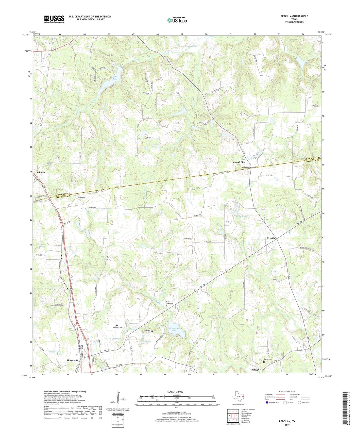
2022 topographic map quadrangle Percilla in the state of Texas. Scale: 1:24000. Based on the newly updated USGS 7.5' US Topo map series, this map is in the following counties: Houston, Anderson. The map contains contour data, water features, and other items you are used to seeing on USGS maps, but also has updated roads and other features. This is the next generation of topographic maps. Printed on high-quality waterproof paper with UV fade-resistant inks.
Quads adjacent to this one:
West: Elkhart Creek
Northwest: Southeast Palestine
North: Slocum
Northeast: Denson Springs
East: Augusta
Southeast: Crockett NE
South: Grapeland
Southwest: Hays Spring
This map covers the same area as the classic USGS quad with code o31095e4.
Contains the following named places: Brown Cemetery, Dunham-Harmon Cemetery, Eleck Turk Grave, Enon Cemetery, Enon School, Evergreen Church, Fielder Chapel, Fort Brown, Grapeland Lake, Grapeland Lake Dam, Green Springs, Guiceland School, Gulceville Cemetery, Houston Mound, Houston Mound Historical Marker, Ioni Lake, Ioni Lake Dam, Ioni Marsh, Johnston Cemetery, Livelyville Church, Mill Branch, Mill Branch Water Wheel, Mound City, Murphy Dam, Murphy Lake, Old Enon Church, Old Enon School, Percilla, Refuge, Refuge Cemetery, Saddler Creek, Salmon, Sand Flat Church, Shiloh Church, Story Springs, Strong Memorial Park, Sunset Church, Union School, Walling Brick Factory, Wilkins Dam, Wilkins Lake, Yarborough Springs, ZIP Code: 75844