MyTopo
High Island Texas US Topo Map
Couldn't load pickup availability
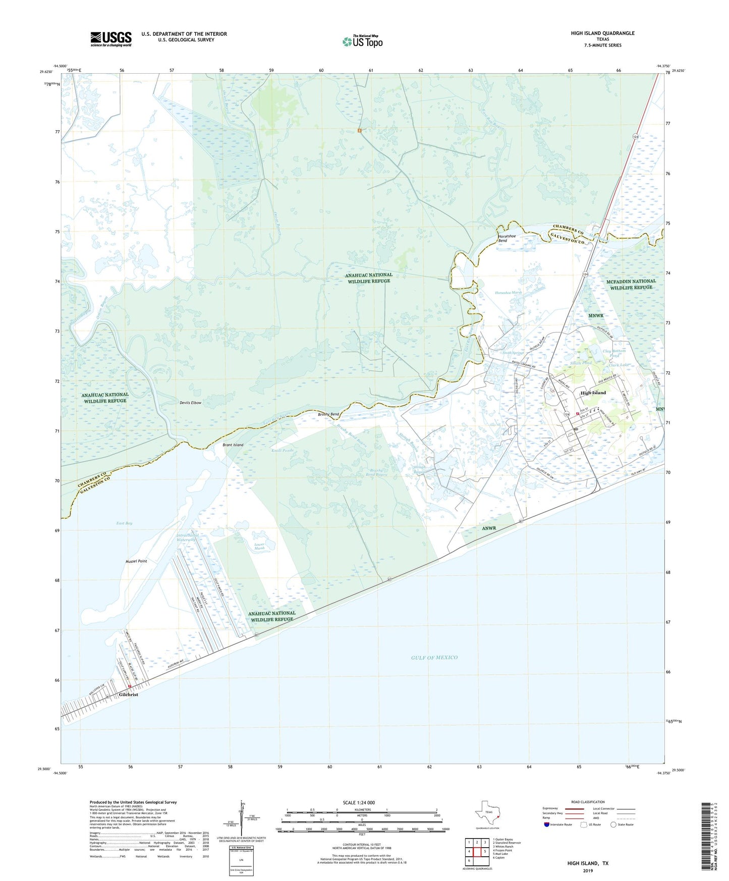
2025 topographic map quadrangle High Island in the state of Texas. Scale: 1:24000. Based on the newly updated USGS 7.5' US Topo map series, this map is in the following counties: Chambers, Galveston. The map contains contour data, water features, and other items you are used to seeing on USGS maps, but also has updated roads and other features. This is the next generation of topographic maps. Printed on high-quality waterproof paper with UV fade-resistant inks.
Quads adjacent to this one:
West: Frozen Point
Northwest: Oyster Bayou
North: Stanolind Reservoir
Northeast: Whites Ranch
East: Mud Lake
Southwest: Caplen
This map covers the same area as the classic USGS quad with code o29094e4.
Contains the following named places: Anahuac National Wildlife Refuge, Brant Island, Brushy Bend, Brushy Bend Bayou, Clark Lake, Clay Bottom Pond, Devils Elbow, East Bay Bayou, Gilchrist, Gilchrist Volunteer Fire Department, High Island, High Island Elementary School, High Island Emergency Medical Services, High Island High School, High Island Middle School, High Island Post Office, High Island Recreational Vehicle Park, High Island Station, High Island Volunteer Fire Department, Horseshoe Bend, Horseshoe Marsh, Knoll Ponds, Lone Tree Bayou, Lower Marsh, Mud Bayou, Mussel Point, Onion Bayou, Oyster Bayou, Rollover Bay, Smith Pond, Smith Springs, Stanolid Slip, Stough Bayou, ZIP Code: 77623