MyTopo
Frozen Point Texas US Topo Map
Couldn't load pickup availability
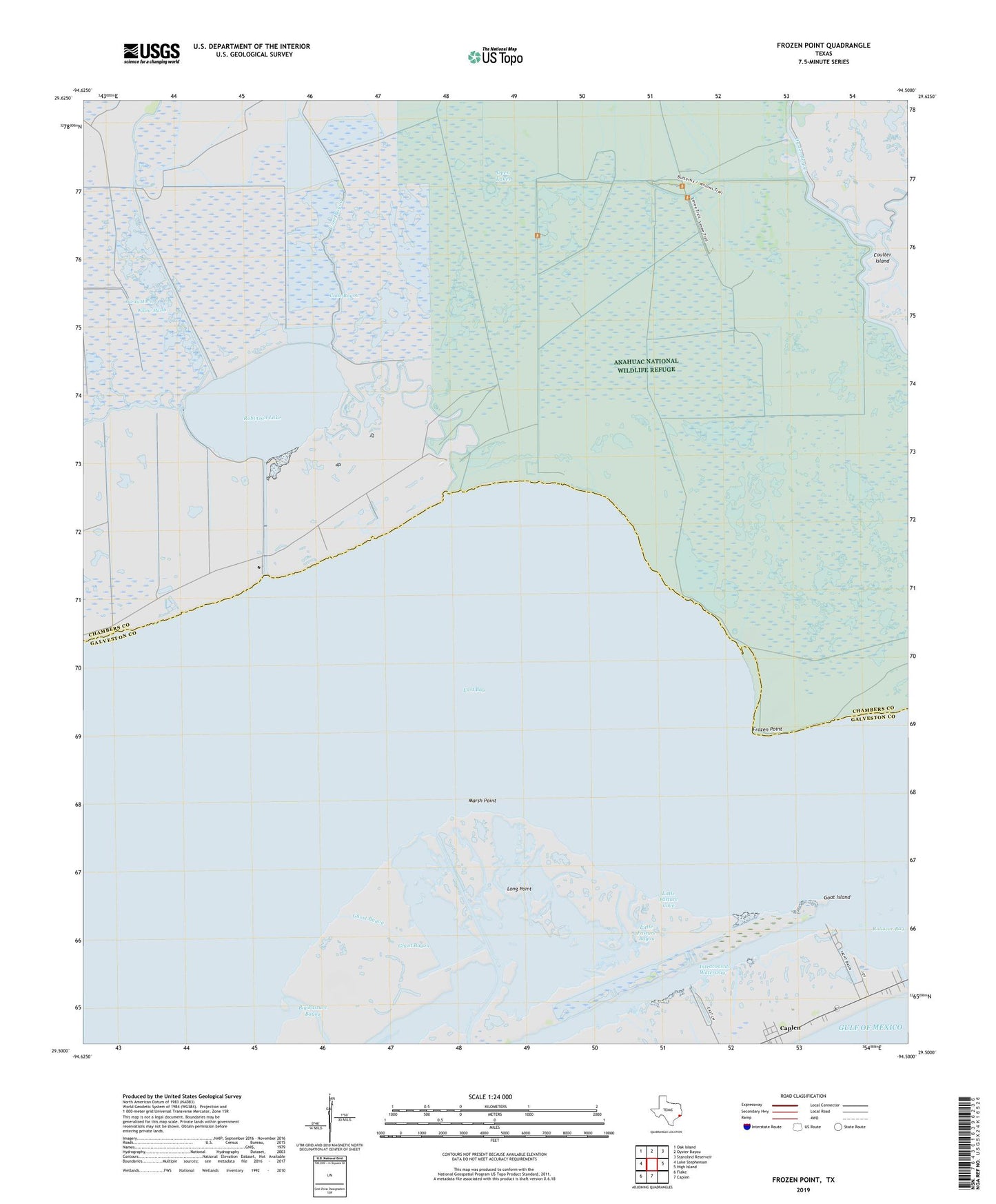
2025 topographic map quadrangle Frozen Point in the state of Texas. Scale: 1:24000. Based on the newly updated USGS 7.5' US Topo map series, this map is in the following counties: Chambers, Galveston. The map contains contour data, water features, and other items you are used to seeing on USGS maps, but also has updated roads and other features. This is the next generation of topographic maps. Printed on high-quality waterproof paper with UV fade-resistant inks.
Quads adjacent to this one:
West: Lake Stephenson
Northwest: Oak Island
North: Oyster Bayou
Northeast: Stanolind Reservoir
East: High Island
South: Caplen
Southwest: Flake
This map covers the same area as the classic USGS quad with code o29094e5.
Contains the following named places: Anahuac National Wildlife Refuge Trail, Cane Bayou, Coulter Island, East Robinson Lake Gas Field, Frozen Point, Ghost Bayou, Little Pasture Bayou, Little Pasture Cove, Long Point, Marsh Point, Open Lakes, Robinson Bayou, Robinson Lake, Rollover, Rollover Pass, Sun Oil Company Canal, Willow Marsh, ZIP Code: 77617