MyTopo
Lebanon Oklahoma US Topo Map
Couldn't load pickup availability
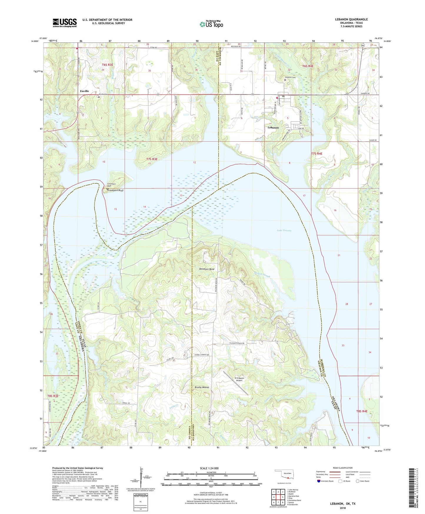
2022 topographic map quadrangle Lebanon in the states of Oklahoma, Texas. Scale: 1:24000. Based on the newly updated USGS 7.5' US Topo map series, this map is in the following counties: Love, Marshall, Grayson, Cooke. The map contains contour data, water features, and other items you are used to seeing on USGS maps, but also has updated roads and other features. This is the next generation of topographic maps. Printed on high-quality waterproof paper with UV fade-resistant inks.
Quads adjacent to this one:
West: Marietta East
Northwest: Lake Murray
North: McMillan
Northeast: Madill
East: Shay
Southeast: Gordonville
South: Dexter
Southwest: Horseshoe Bend
Contains the following named places: Boggy Creek, Briar Creek, Brushy Mound, Catlin Creek, Comet Landing Strip, Currie Lake, Currie Lake Dam, Delaware Bend, Enville, Enville Cemetery, Enville Fire Department, Graveyard Bluff, Hickory Creek, Hickory Creek Public Use Area, Hickory Creek State Game Management Area, House Creek, Jenny Creek, Lebanon, Lebanon Airport, Lebanon Cemetery, Lebanon Census Designated Place, Lebanon Fire Department, Lebanon Post Office, Lebanon Public Use Area, Little Hauani Creek, Loves Valley State Game Management Area, Orlena, Salt Creek, Slickum Slough, U U Ranch Airport, Wilson Creek, ZIP Code: 73440