MyTopo
Jacksonville East Texas US Topo Map
Couldn't load pickup availability
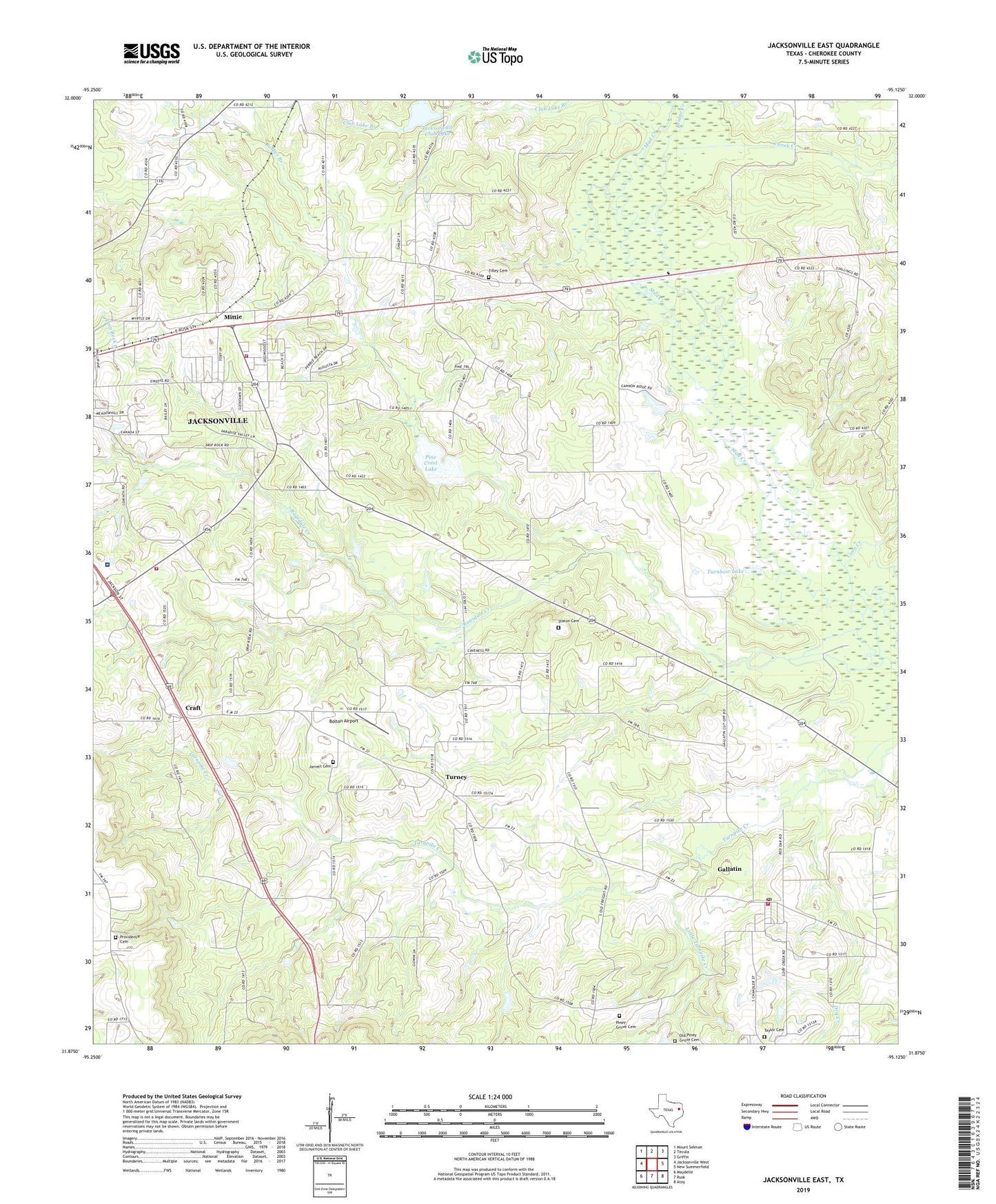
2019 topographic map quadrangle Jacksonville East in the state of Texas. Scale: 1:24000. Based on the newly updated USGS 7.5' US Topo map series, this map is in the following counties: Cherokee. The map contains contour data, water features, and other items you are used to seeing on USGS maps, but also has updated roads and other features. This is the next generation of topographic maps. Printed on high-quality waterproof paper with UV fade-resistant inks.
Quads adjacent to this one:
West: Jacksonville West
Northwest: Mount Selman
North: Tecula
Northeast: Griffin
East: New Summerfield
Southeast: Atoy
South: Rusk
Southwest: Maydelle
Contains the following named places: Afton Grove Church, Barber Branch, Bolton Airport, Bridge Creek, Caney Creek, Cherokee Country Club, Cherokee County Constable's Office Precinct 1, CHRISTUS Mother Frances Hospital - Jacksonville, City of Gallatin, Coon Creek, Corinth Church, Craft, Drip Rock Creek, Dry Creek, First Baptist Church, Gallatin, Gallatin Post Office, Gallatin Volunteer Fire Department, Jacksonville Club Lake, Jacksonville Club Lake Dam, Jacksonville Fire Department Station 2, Jarrett Cemetery, Little Turnpike Creek, Mittie, Old Piney Grove Cemetery, Pine Crest Lake, Pine Crest Lake Dam, Piney Grove Cemetery, Providence Cemetery, Providence Church, Ragsdale Creek, Simmer Lake, Simmer Lake Dam, Staton Cemetery, Taylor Cemetery, Texas Forest Service Jacksonville Office, Tilley Cemetery, Turnbow Lake, Turney, ZIP Code: 75764