MyTopo
Maydelle Texas US Topo Map
Couldn't load pickup availability
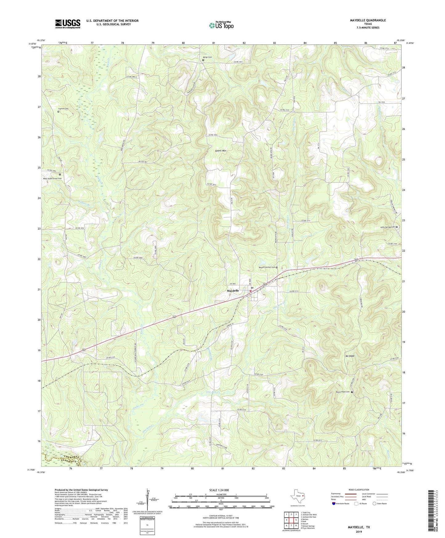
2022 topographic map quadrangle Maydelle in the state of Texas. Scale: 1:24000. Based on the newly updated USGS 7.5' US Topo map series, this map is in the following counties: Cherokee, Anderson. The map contains contour data, water features, and other items you are used to seeing on USGS maps, but also has updated roads and other features. This is the next generation of topographic maps. Printed on high-quality waterproof paper with UV fade-resistant inks.
Quads adjacent to this one:
West: Neches
Northwest: Todd City
North: Jacksonville West
Northeast: Jacksonville East
East: Rusk
Southeast: Pryor Mountain
South: Denson Springs
Southwest: Slocum
This map covers the same area as the classic USGS quad with code o31095g3.
Contains the following named places: Berge Cemetery, Brigman Branch, Fairchild State Forest, Ghent Mountain, Gum Creek, Holleman Chapel, Holly Springs Cemetery, Java, Maydelle, Maydelle Post Office, Maydelle Volunteer Fire Department, Mewshaw, Mount Comfort Cemetery, Mount Hope, Mount Hope Cemetery, Mount Hope School, Mount Hope Tract Trail, Nature Trail, One Arm Creek, Pine Grove School, Pleasant Grove Church, Tillman Cemetery, Union Grove Church, Wallace Branch, West Shady Grove Cemetery, West Shady Grove Church, Wilson Chapel