MyTopo
New Summerfield Texas US Topo Map
Couldn't load pickup availability
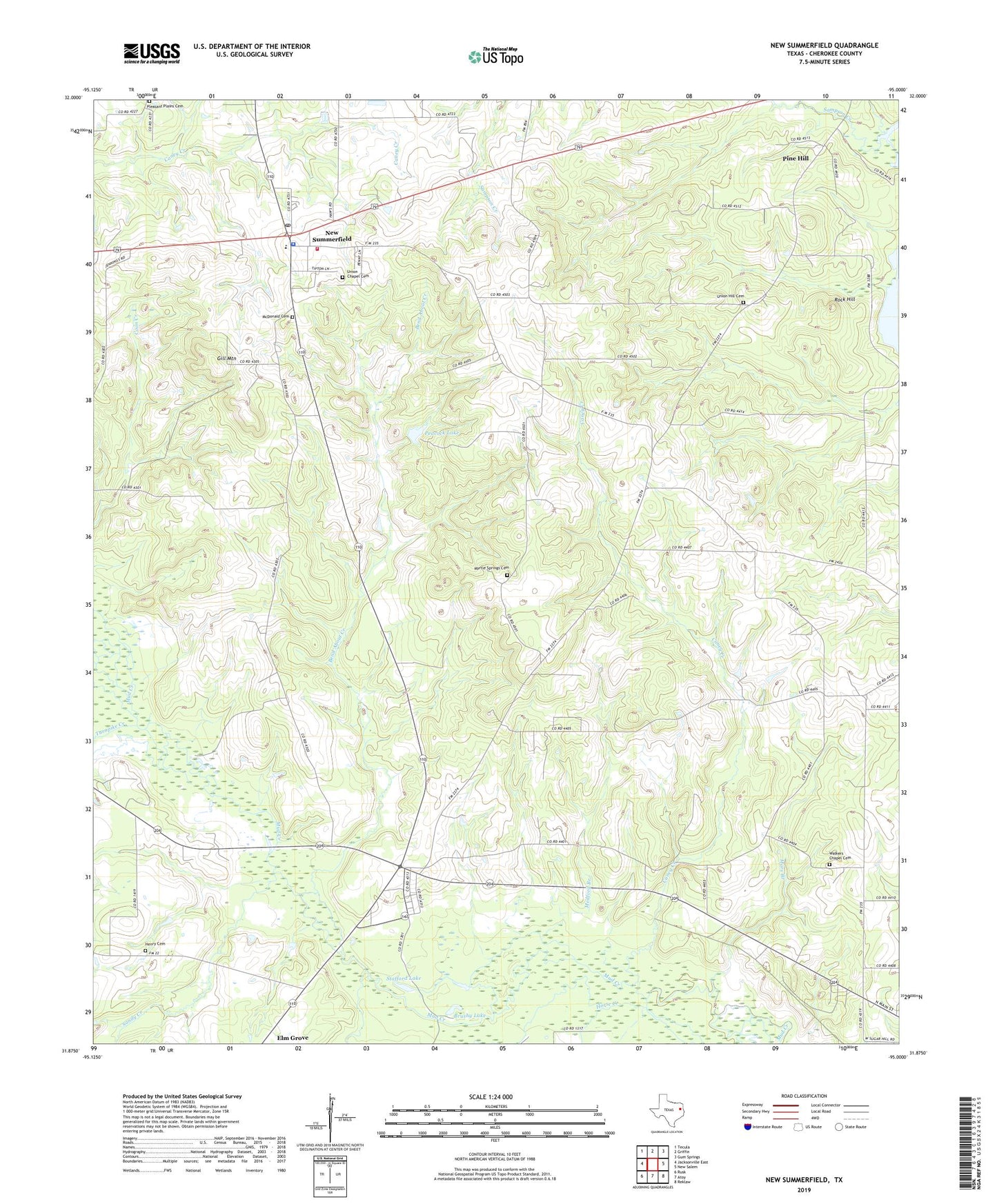
2022 topographic map quadrangle New Summerfield in the state of Texas. Scale: 1:24000. Based on the newly updated USGS 7.5' US Topo map series, this map is in the following counties: Cherokee. The map contains contour data, water features, and other items you are used to seeing on USGS maps, but also has updated roads and other features. This is the next generation of topographic maps. Printed on high-quality waterproof paper with UV fade-resistant inks.
Quads adjacent to this one:
West: Jacksonville East
Northwest: Tecula
North: Griffin
Northeast: Gum Springs
East: New Salem
Southeast: Reklaw
South: Atoy
Southwest: Rusk
This map covers the same area as the classic USGS quad with code o31095h1.
Contains the following named places: Bend About Creek, Bird Pond, Brushy Lake, Caney Creek, Cherokee County Constable's Office Precinct 4, City of New Summerfield, Gill Mountain, Henry Cemetery, Horse Creek, Hudspeth Creek, Lone Star, Mars Branch, McDonald Cemetery, Medford Branch, Myrtle Springs Cemetery, New Summerfield, New Summerfield City Hall, New Summerfield Police Department, New Summerfield Post Office, New Summerfield Volunteer Fire Department, Peacock Lake, Peacock Lake Dam, Pine Hill, Pleasant Plains Cemetery, Ponta, Rock Hill, Sampson Creek, Sandy Creek, Stafford Lake, Stryker Creek Junction, Turnpike Creek, Union Chapel Cemetery, Union Church, Union Hill Cemetery, Vales Church, Walkers Chapel Cemetery, ZIP Code: 75780