MyTopo
Atoy Texas US Topo Map
Couldn't load pickup availability
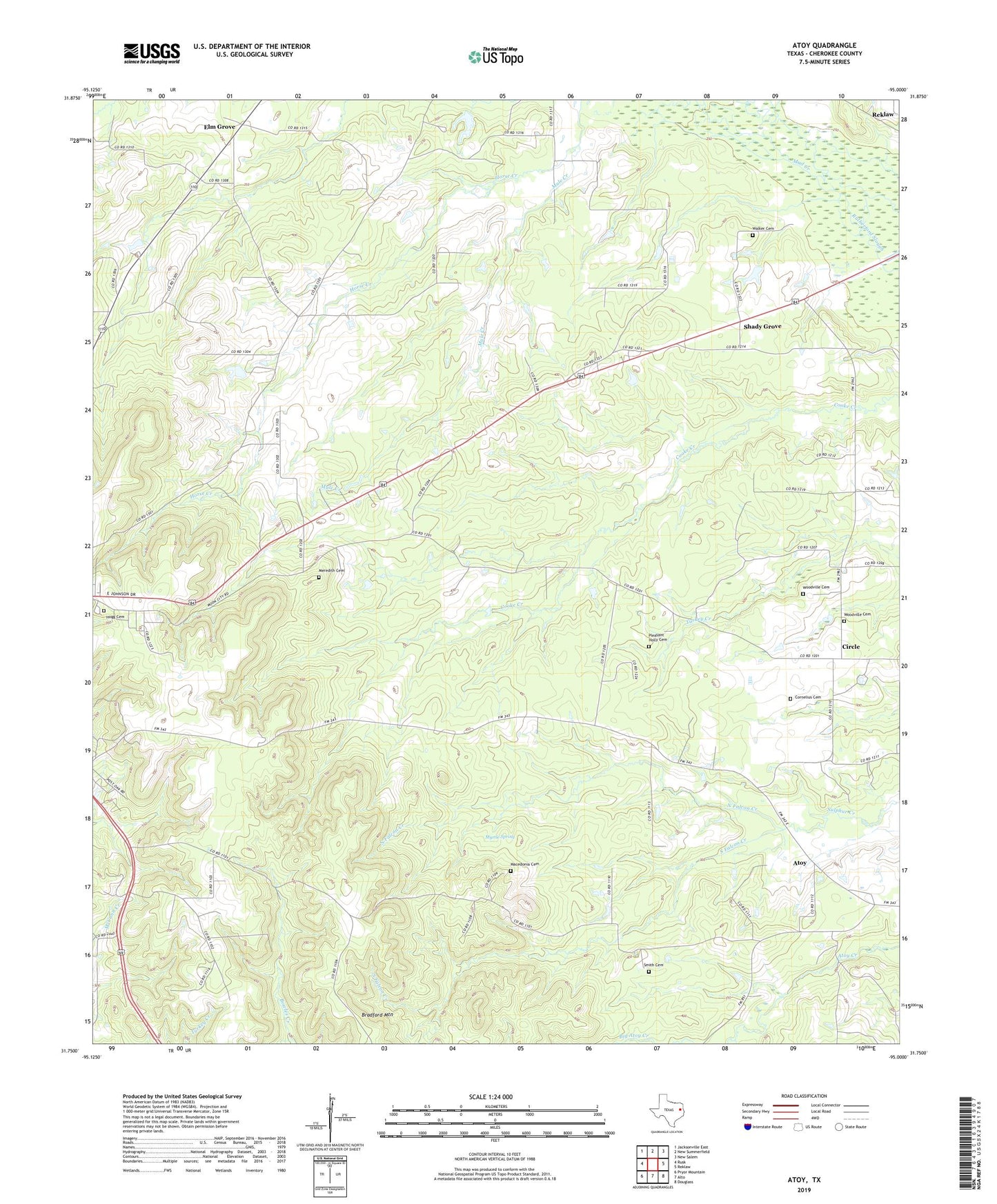
2022 topographic map quadrangle Atoy in the state of Texas. Scale: 1:24000. Based on the newly updated USGS 7.5' US Topo map series, this map is in the following counties: Cherokee. The map contains contour data, water features, and other items you are used to seeing on USGS maps, but also has updated roads and other features. This is the next generation of topographic maps. Printed on high-quality waterproof paper with UV fade-resistant inks.
Quads adjacent to this one:
West: Rusk
Northwest: Jacksonville East
North: New Summerfield
Northeast: New Salem
East: Reklaw
Southeast: Douglass
South: Alto
Southwest: Pryor Mountain
This map covers the same area as the classic USGS quad with code o31095g1.
Contains the following named places: Atoy, Bethel Church, Blounts Church, Bradford Mountain, Circle, Cornelius Cemetery, Elm Grove, Hogg Cemetery, Jim Hogg State Historical Park Trail, Lowes Church, Macedonia Cemetery, Meredith Cemetery, Mount Cove Church, Mule Creek, Myrtle Spring, Myrtle Springs Church, North Falcon Creek, Pleasant Holly Cemetery, Pleasant Holly Church, Rusk Lookout Tower, Rutherford Slough, Shady Grove, Shady Grove Church, Smith Cemetery, South Falcon Creek, Walker Cemetery, Woodville Cemetery, Woodville Church, Woodville Community Center