MyTopo
Holland Texas US Topo Map
Couldn't load pickup availability
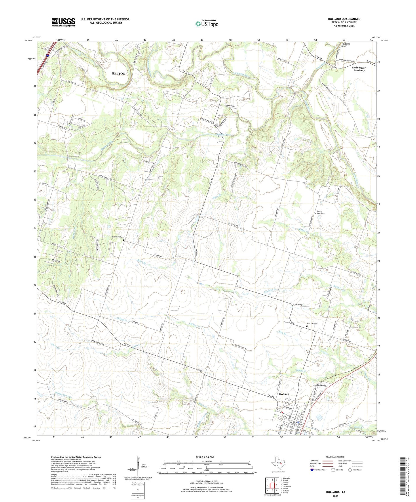
2022 topographic map quadrangle Holland in the state of Texas. Scale: 1:24000. Based on the newly updated USGS 7.5' US Topo map series, this map is in the following counties: Bell. The map contains contour data, water features, and other items you are used to seeing on USGS maps, but also has updated roads and other features. This is the next generation of topographic maps. Printed on high-quality waterproof paper with UV fade-resistant inks.
Quads adjacent to this one:
West: Salado
Northwest: Nolanville
North: Belton
Northeast: Temple
East: Little River
Southeast: Davilla
South: Bartlett
Southwest: Jarrell
This map covers the same area as the classic USGS quad with code o30097h4.
Contains the following named places: Armstrong Community Center, Bell County Justice of the Peace Number 2 Courthouse, Bell Plains Cemetery, BJ Hill Library, Bowman Middle School, Center Lake Cemetery, Childers Mill, City of Holland Water Tower, Elm Grove Church, First Baptist Church, First United Methodist Church, Five Wells Roping Rodeo Arena, Flag Branch, Holland, Holland Branch, Holland Cemetery, Holland Church of Christ, Holland City Hall, Holland Elementary School, Holland Headstart School, Holland High School, Holland Police Department, Holland Post Office, Holland Substation, Holland Volunteer Fire Department - EMS Services, Iglesia Bautista Nueva Esperanza, JB Rodeo Arena, Kuhlmann Civic Center, La Iglesia Pentecostes El Cristo, Lampasas River, Leon River, Mayfield-Dobbs Museum, Middle Darrs Creek, Mitchell Branch, Moon Branch, Post Oak Cemetery, Salado Creek, Scott & White Emergency Medical Station, Summers Mill, Town of Holland, ZIP Codes: 76534, 76554