MyTopo
Joy Hollow Texas US Topo Map
Couldn't load pickup availability
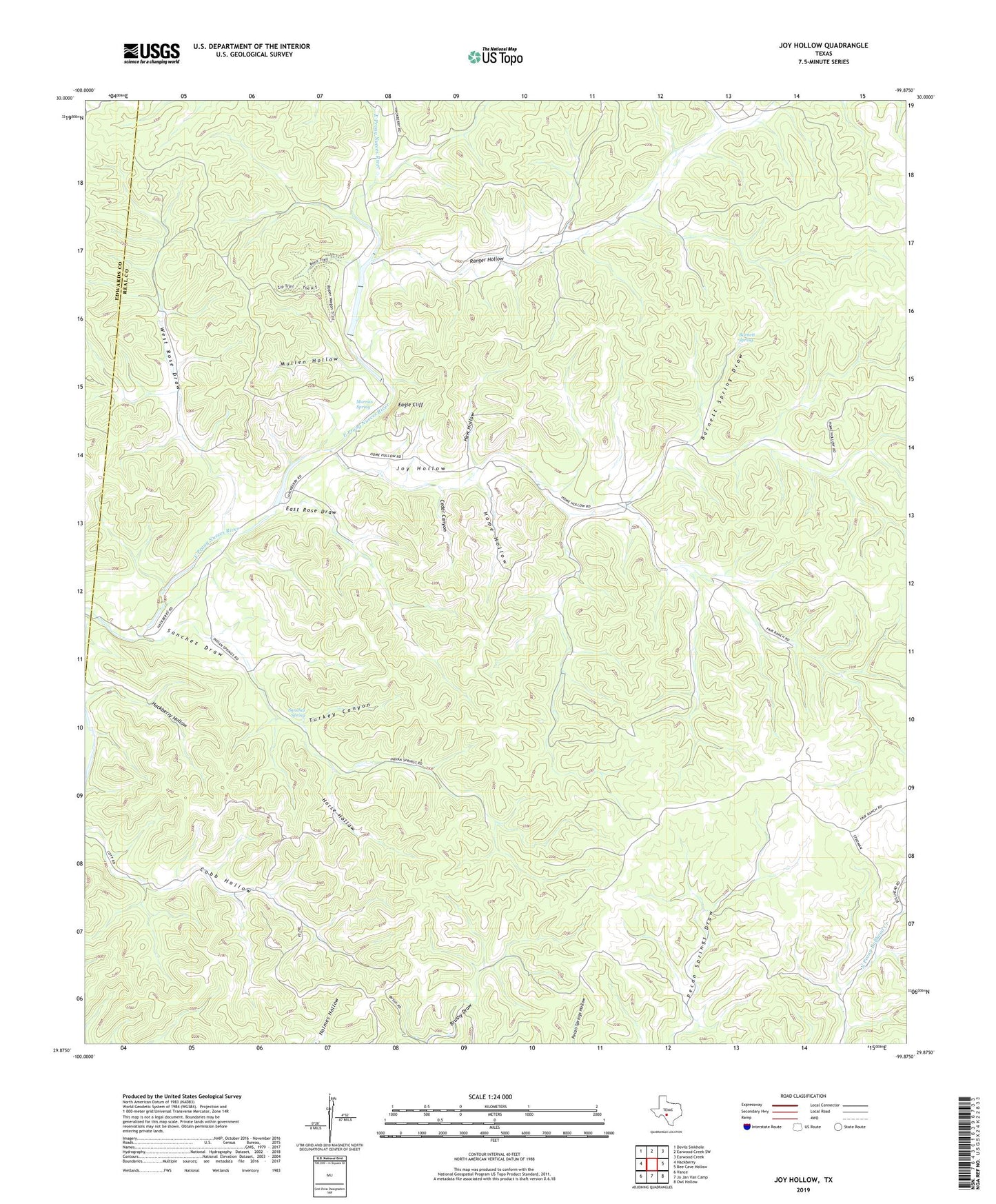
2022 topographic map quadrangle Joy Hollow in the state of Texas. Scale: 1:24000. Based on the newly updated USGS 7.5' US Topo map series, this map is in the following counties: Real, Edwards. The map contains contour data, water features, and other items you are used to seeing on USGS maps, but also has updated roads and other features. This is the next generation of topographic maps. Printed on high-quality waterproof paper with UV fade-resistant inks.
Quads adjacent to this one:
West: Hackberry
Northwest: Devils Sinkhole
North: Earwood Creek SW
Northeast: Earwood Creek
East: Bee Cave Hollow
Southeast: Owl Hollow
South: Jo Jan Van Camp
Southwest: Vance
This map covers the same area as the classic USGS quad with code o29099h8.
Contains the following named places: Barnett Spring, Barnett Spring Draw, Blue Hole, Cedar Canyon, Eagle Cliff, Eagle Ranch, Eagle Ranch Lake Number 2, Eagle Ranch Lake Number 2 Dam, East Rose Draw, Greenwood Valley Ranch, Haw Hollow, Home Hollow, Horse Hollow, Joy Hollow, Kaolin Mine, Morriss Spring, Mullen Hollow, Ranger Hollow, Sanchez Draw, Sanchez Spring, Turkey Canyon, West Rose Draw