MyTopo
Johnson Lake Texas US Topo Map
Couldn't load pickup availability
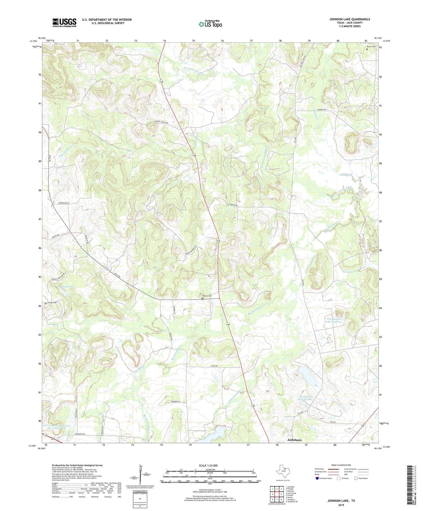
2019 topographic map quadrangle Johnson Lake in the state of Texas. Scale: 1:24000. Based on the newly updated USGS 7.5' US Topo map series, this map is in the following counties: Jack. The map contains contour data, water features, and other items you are used to seeing on USGS maps, but also has updated roads and other features. This is the next generation of topographic maps. Printed on high-quality waterproof paper with UV fade-resistant inks.
Quads adjacent to this one:
West: Lynn Creek
Northwest: Antelope
North: Postoak
Northeast: Newport
East: Cundiff
Southeast: Jacksboro NE
South: Jacksboro
Southwest: Senate
Contains the following named places: Big Cleveland Creek, Brown Cemetery, Crooked Creek, Flag Springs Creek, Graves Cemetery, Jacksboro Division, Johnson Lake, Jones Creek, Little Cleveland Creek, North Creek, Patton Cemetery, Prunty Lake, Prunty Lake Dam, Pursley Branch, Soil Conservation Service Site 18 Dam, Soil Conservation Service Site 18 Reservoir, Soil Conservation Service Site 21 Dam, Soil Conservation Service Site 21 Reservoir, Worthington Lake, Worthington Lake Dam, Worthington Lake Number 2, Worthington Lake Number 2 Dam, Worthington Lake Number 3, Worthington Lake Number 3 Dam