MyTopo
Kendleton Texas US Topo Map
Couldn't load pickup availability
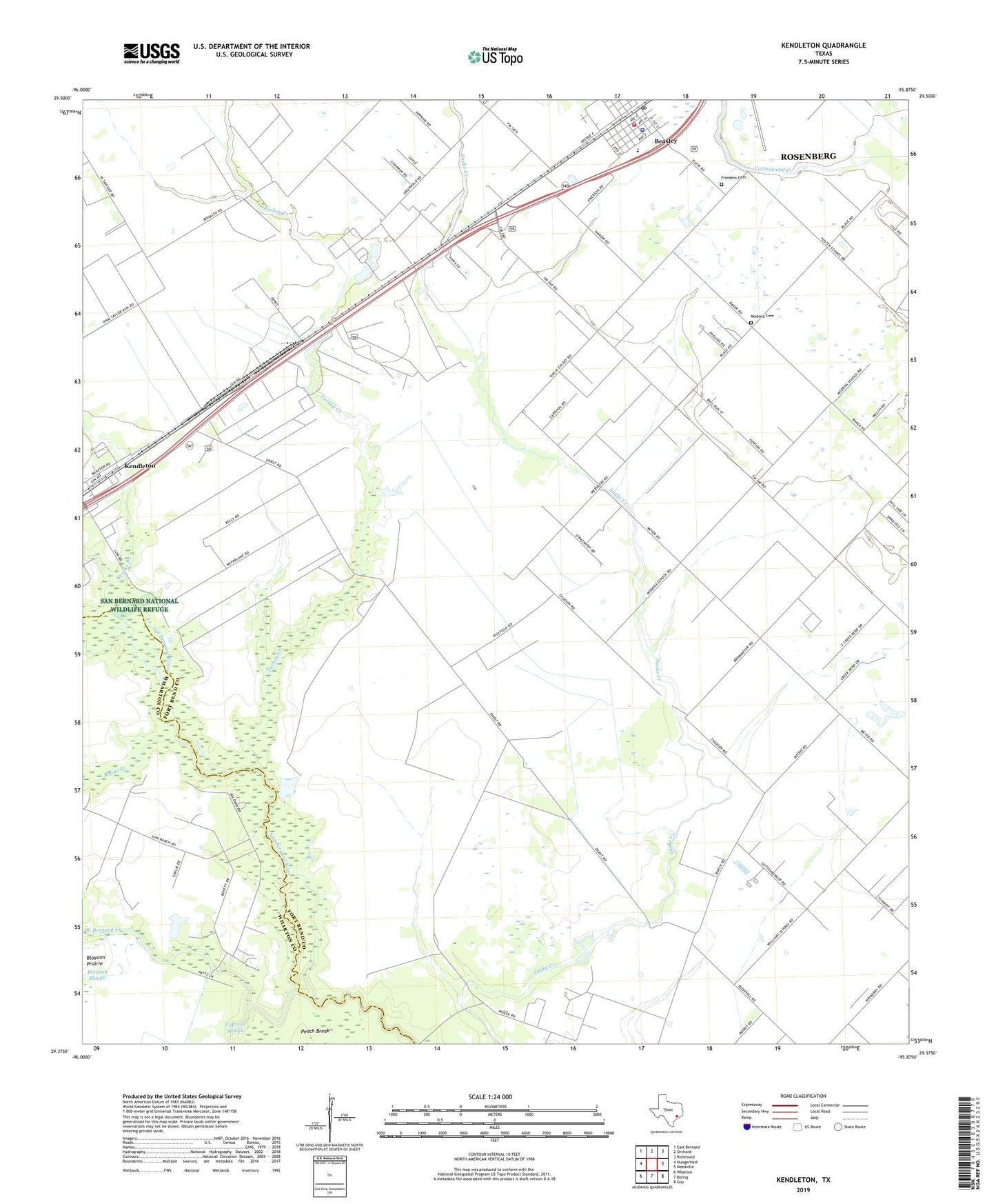
2019 topographic map quadrangle Kendleton in the state of Texas. Scale: 1:24000. Based on the newly updated USGS 7.5' US Topo map series, this map is in the following counties: Fort Bend, Wharton. The map contains contour data, water features, and other items you are used to seeing on USGS maps, but also has updated roads and other features. This is the next generation of topographic maps. Printed on high-quality waterproof paper with UV fade-resistant inks.
Quads adjacent to this one:
West: Hungerford
Northwest: East Bernard
North: Orchard
Northeast: Richmond
East: Needville
Southeast: Guy
South: Boling
Southwest: Wharton
Contains the following named places: Aviasud Airpark, Beasley, Beasley City Hall, Beasley Elementary School, Beasley Police Department, Beasley Post Office, Beasley Volunteer Fire Department, Boone Branch, Brooks Branch, City of Beasley, Friedens Cemetery, Henry G and Annie B Green House, Historical Marker, Houston Fort Bend Airport, Kendleton, Modena Cemetery, Newman Chapel United Methodist Church, Purdy-nielsen Memorial Airpark, Texas No Name Number 43 Dam, Turkey Creek, Wesley Chapel, West Bernard Creek, ZIP Code: 77417