MyTopo
Kenney Texas US Topo Map
Couldn't load pickup availability
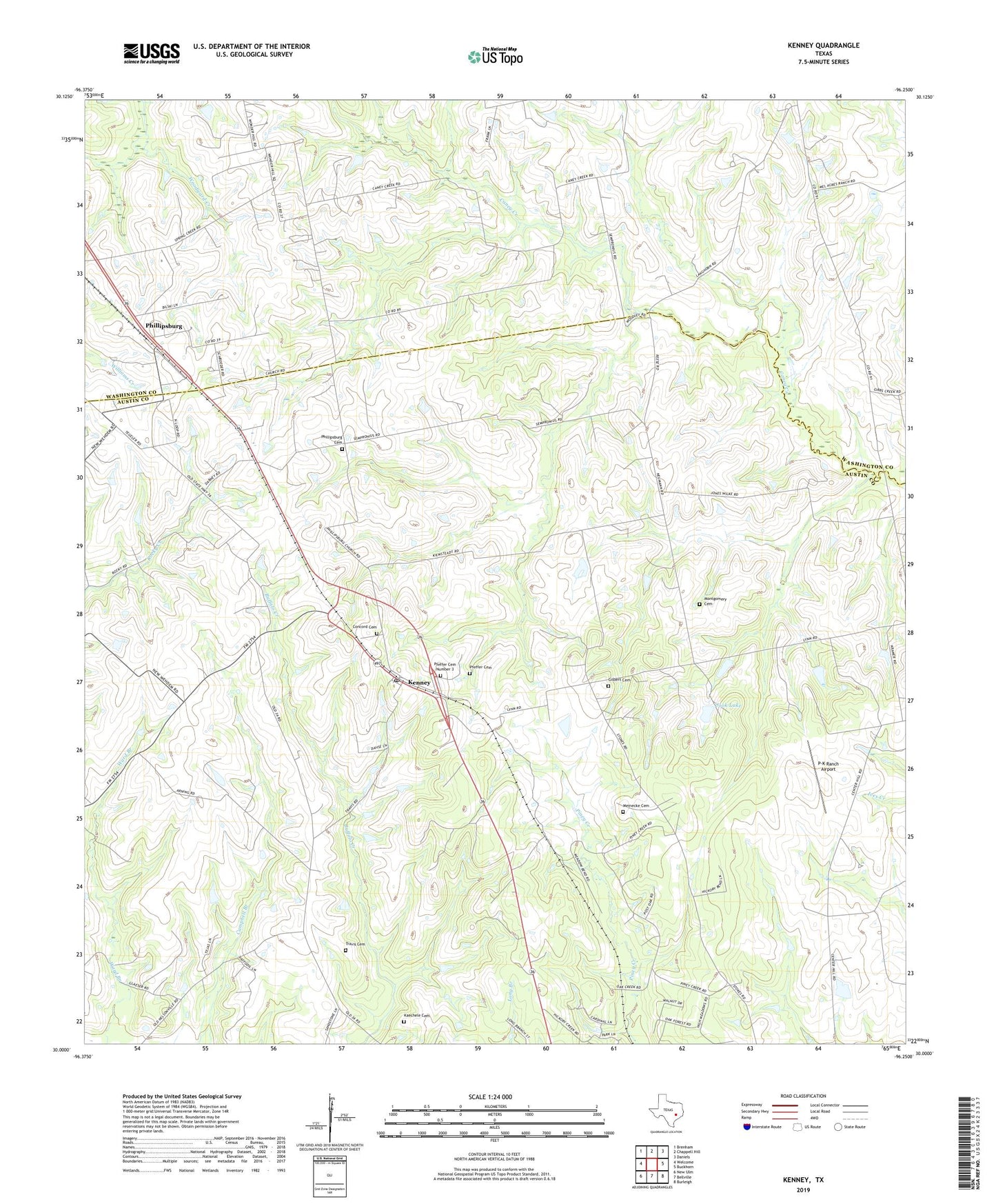
2019 topographic map quadrangle Kenney in the state of Texas. Scale: 1:24000. Based on the newly updated USGS 7.5' US Topo map series, this map is in the following counties: Austin, Washington. The map contains contour data, water features, and other items you are used to seeing on USGS maps, but also has updated roads and other features. This is the next generation of topographic maps. Printed on high-quality waterproof paper with UV fade-resistant inks.
Quads adjacent to this one:
West: Welcome
Northwest: Brenham
North: Chappell Hill
Northeast: Daniels
East: Buckhorn
Southeast: Burleigh
South: Bellville
Southwest: New Ulm
Contains the following named places: Concord Cemetery, Cook Lake, Cook Lake Dam, Gilbert Cemetery, Gilbert Chapel, Hinson Airport, Kachele Cemetery, Kenney, Kenney Post Office, Kenney-New-Wehdem School, Meinecke Cemetery, Montgomery Cemetery, New Wehdem, Pfeffer Cemetery, Phillipsburg, Phillipsburg Cemetery, P-K Ranch Airport, Sempronius, Streb Cemetery, Travis Cemetery, ZIP Code: 77426