MyTopo
Burleigh Texas US Topo Map
Couldn't load pickup availability
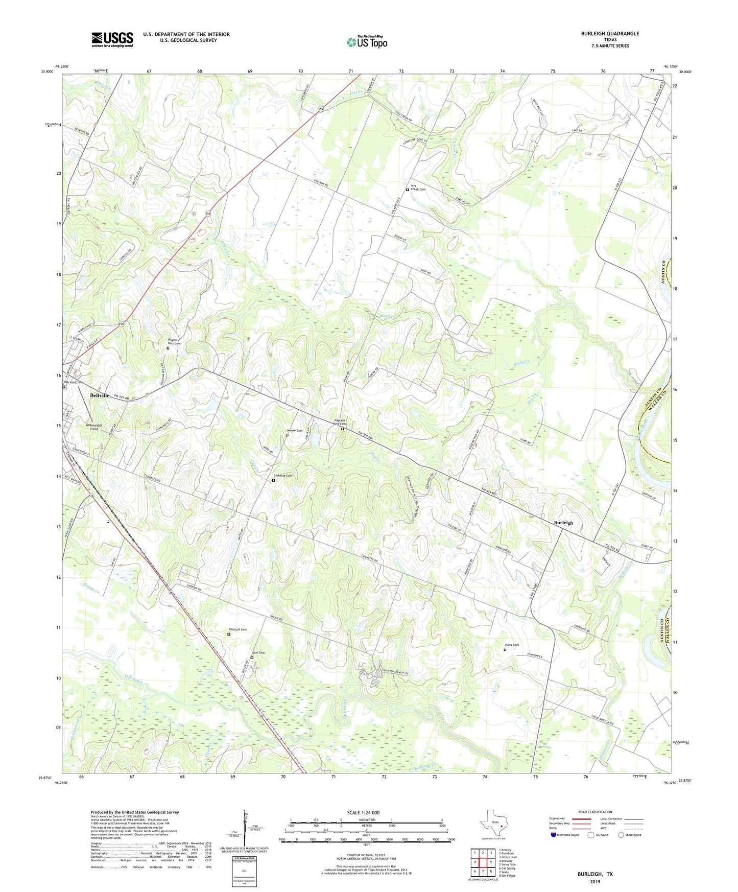
2022 topographic map quadrangle Burleigh in the state of Texas. Scale: 1:24000. Based on the newly updated USGS 7.5' US Topo map series, this map is in the following counties: Austin, Waller. The map contains contour data, water features, and other items you are used to seeing on USGS maps, but also has updated roads and other features. This is the next generation of topographic maps. Printed on high-quality waterproof paper with UV fade-resistant inks.
Quads adjacent to this one:
West: Bellville
Northwest: Kenney
North: Buckhorn
Northeast: Hempstead
East: Sunny Side
Southeast: San Felipe
South: Sealy
Southwest: Cat Spring
This map covers the same area as the classic USGS quad with code o29096h2.
Contains the following named places: Abel Cemetery, Bellville City Park, Bellville Division, Bellville Yards, Boggy Creek, Burleigh, City Park, Clear Creek, Constance Creek, Coshatte Agricultural Society Hall, Coshatte Cemetery, Deadman Creek, Dethloff Cemetery, Dry Creek, Grant School, Grants Chapel, Grawunder Field, Holtz Cemetery, Ives Creek, Ivys Creek Cemetery, Menke Cemetery, Muddy Branch, Pilgrims Rest Cemetery, Piney Creek, Piney School, Pleasant Grove Church, Racoon Bend Oil Field, Saint Paul Church, Truvine Church