MyTopo
La Leona Texas US Topo Map
Couldn't load pickup availability
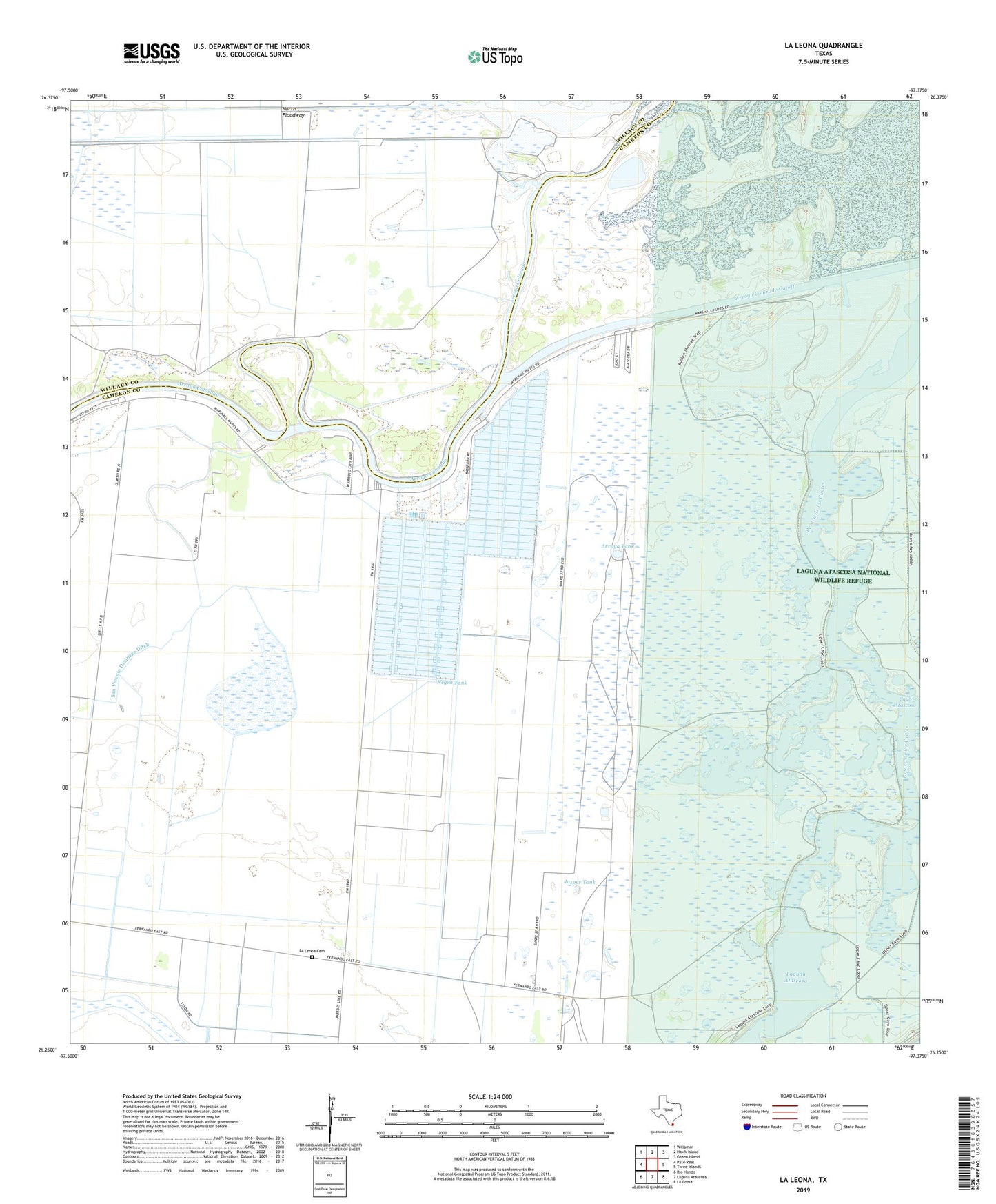
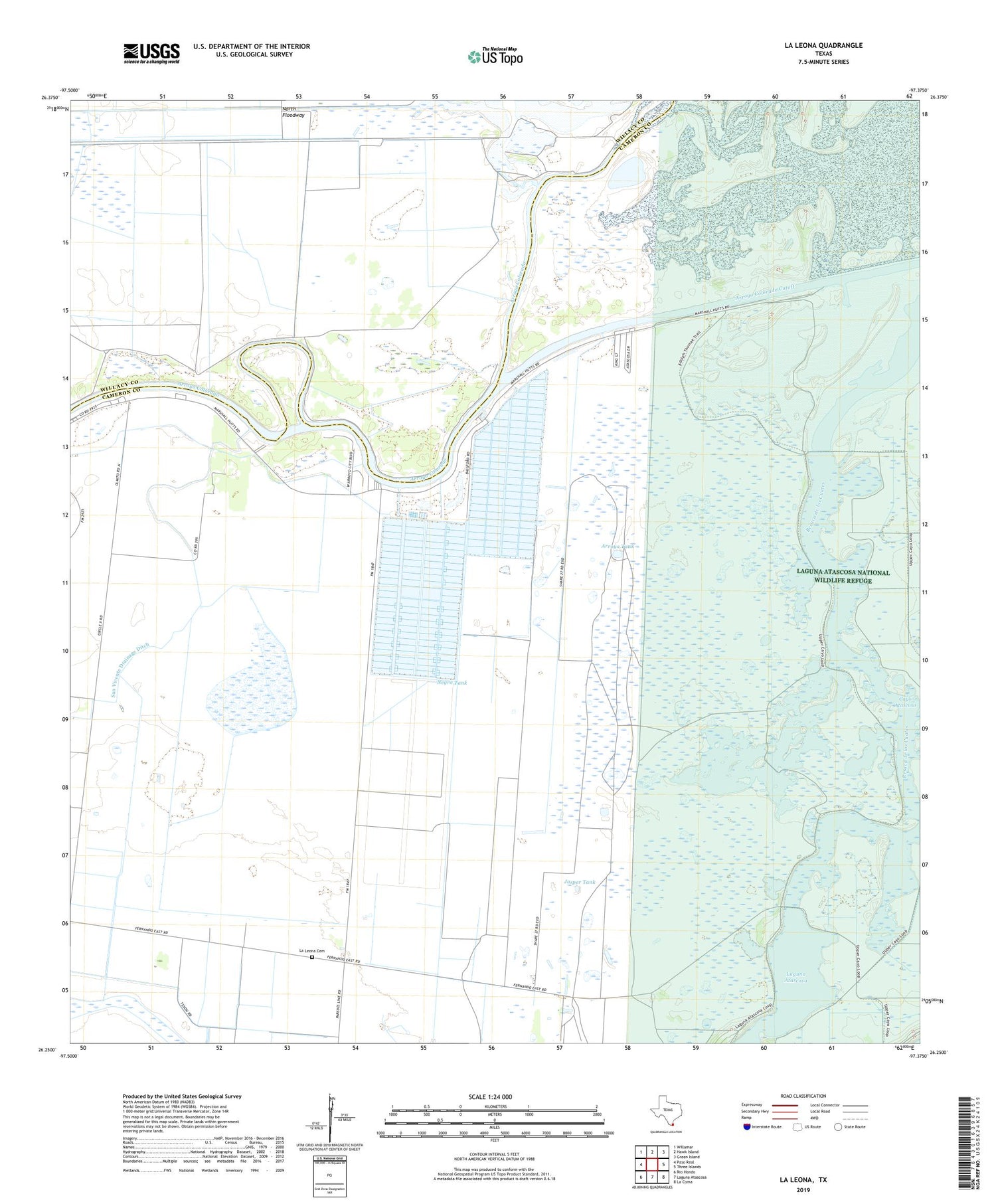
2019 topographic map quadrangle La Leona in the state of Texas. Scale: 1:24000. Based on the newly updated USGS 7.5' US Topo map series, this map is in the following counties: Cameron, Willacy. The map contains contour data, water features, and other items you are used to seeing on USGS maps, but also has updated roads and other features. This is the next generation of topographic maps. Printed on high-quality waterproof paper with UV fade-resistant inks.
Quads adjacent to this one:
West: Paso Real
Northwest: Willamar
North: Hawk Island
Northeast: Green Island
East: Three Islands
Southeast: La Coma
South: Laguna Atascosa
Southwest: Rio Hondo
Contains the following named places: Armendaiz Levee, Armendaiz Reservoir, Arroyo City, Arroyo City RV Resort Marina, Arroyo City Subdivision Colonia, Arroyo Colorado Cutoff, Arroyo Tank, Cayo Atascoso, Channel Lots Colonia, Channel View RV Park Marina, Chanpurado Windmill, Chico Tank, Coulson Colonia, El Ranchito, El Sivolo Pond, Jasper Tank, La Leona, La Leona Cemetery, La Leona Ranch, Laguna Atascosa National Wildlife Refuge Trail, Los Angeles Tank, Los Coyotes Ranch, Los Patos Tank, Miradores Ranch, Negro Tank, Rancho Nuevo, Rio Hondo Division, San Vicente Drainage Ditch, Schwartz Colonia, Seaway Village Marina, Texas Air Museum, Totman Ranch, XX Farms Colonia, ZIP Code: 78583