MyTopo
Paso Real Texas US Topo Map
Couldn't load pickup availability
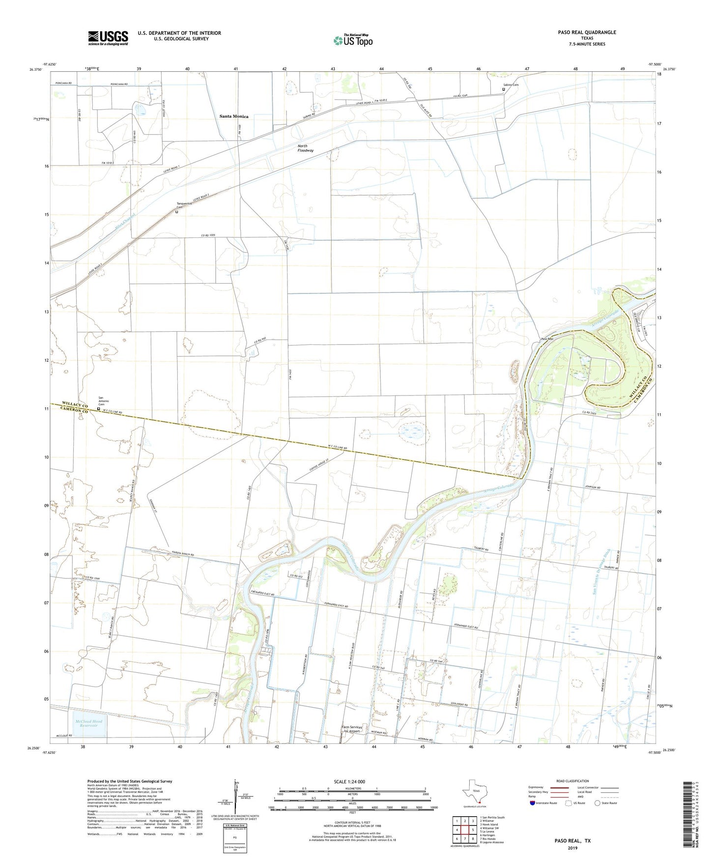
2022 topographic map quadrangle Paso Real in the state of Texas. Scale: 1:24000. Based on the newly updated USGS 7.5' US Topo map series, this map is in the following counties: Cameron, Willacy. The map contains contour data, water features, and other items you are used to seeing on USGS maps, but also has updated roads and other features. This is the next generation of topographic maps. Printed on high-quality waterproof paper with UV fade-resistant inks.
Quads adjacent to this one:
West: Willamar SW
Northwest: San Perlita South
North: Willamar
Northeast: Hawk Island
East: La Leona
Southeast: Laguna Atascosa
South: Rio Hondo
Southwest: Harlingen
This map covers the same area as the classic USGS quad with code o26097c5.
Contains the following named places: Camp Perry, Cantwell Auxiliary Levee, Cantwell Auxiliary Reservoir, Cantwell Main Levee, Cantwell Main Reservoir, Dry Reservoir, Dry Reservoir Dam, Farm Services Inc Airport, Hext Levee, Hext Reservoir, Laguna Escondida Colonia, Laguna Escondida Heights Number 2 Colonia, Las Palomas Wildlife Management Area - Arroyo Colorado Unit, Leisure Time Mobile Home Park Colonia, McCloud Hood Reservoir, McCloud-Hood Levee, Monte Grande, Paso Real, Sabino Cemetery, San Antonio Cemetery, Santa Monica, Santa Monica Census Designated Place, Tanquesitos Cemetery, Tres Norias Ranch