MyTopo
La Parra Ranch Texas US Topo Map
Couldn't load pickup availability
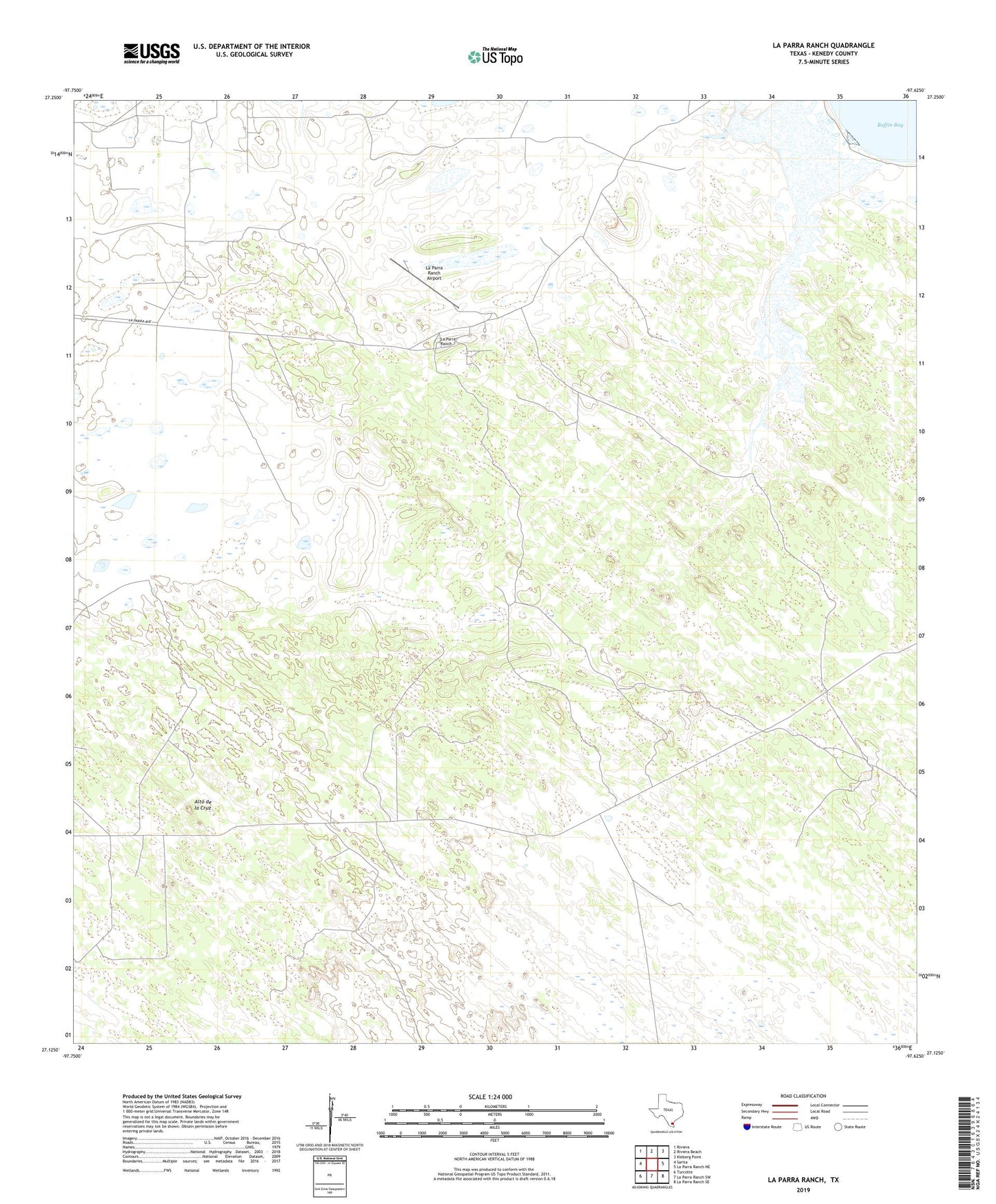
2019 topographic map quadrangle La Parra Ranch in the state of Texas. Scale: 1:24000. Based on the newly updated USGS 7.5' US Topo map series, this map is in the following counties: Kenedy. The map contains contour data, water features, and other items you are used to seeing on USGS maps, but also has updated roads and other features. This is the next generation of topographic maps. Printed on high-quality waterproof paper with UV fade-resistant inks.
Quads adjacent to this one:
West: Sarita
Northwest: Riviera
North: Riviera Beach
Northeast: Kleberg Point
East: La Parra Ranch NE
Southeast: La Parra Ranch SE
South: La Parra Ranch SW
Southwest: Turcotte
Contains the following named places: Alto de la Cruz, Atravesada Artesian Well, Bordas Artesian Well, Cabillos Well, Cobas Well, Eberia Well, La Parra Ranch, La Parra Ranch Airport, Labores Well, Las Flores Artesian Well, Miralejos Artesian Well, Padre Alejos Artesian Well, Pete Artesian Well, Risken Lookout Tower, Risken Well, Tacolote Artesian Well, Tomas Well