MyTopo
Riviera Texas US Topo Map
Couldn't load pickup availability
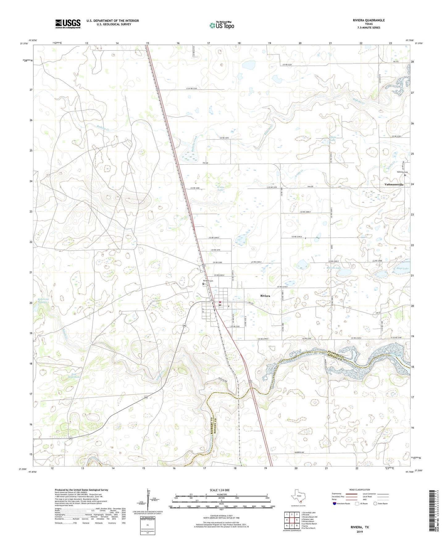
2022 topographic map quadrangle Riviera in the state of Texas. Scale: 1:24000. Based on the newly updated USGS 7.5' US Topo map series, this map is in the following counties: Kleberg, Kenedy. The map contains contour data, water features, and other items you are used to seeing on USGS maps, but also has updated roads and other features. This is the next generation of topographic maps. Printed on high-quality waterproof paper with UV fade-resistant inks.
Quads adjacent to this one:
West: Paisano Lake
Northwest: Escondido Lake
North: Ricardo
Northeast: Riviera Beach NW
East: Riviera Beach
Southeast: La Parra Ranch
South: Sarita
Southwest: La Paloma Ranch
This map covers the same area as the classic USGS quad with code o27097c7.
Contains the following named places: Africana Windmill, American Medical Response, Andrews Windmill, Arana Lake, Boveda Lake, Charro Windmill, De La Paz Middle School, Falcon Chiquita Dam, Hays Lake, King Ranch Dam Number 1, Kleberg County Constable's Office Precinct 3, Kleberg County Fire Rescue Riviera Station, Mota Corpus Windmill, Nanny Elementary School, Our Lady of Consolation Cemetery, Palanca Windmill, Radicha Lake, Rincon de Tio Luis Windmill, Rincon de Tio Pandho Windmill, Riviera, Riviera Cemetery, Riviera Census Designated Place, Riviera Kaufer High School, Riviera Post Office, Rosita Lake, Salado Creek, Seth Waterhole, Vattmannville, ZIP Code: 78379