MyTopo
Sarita Texas US Topo Map
Couldn't load pickup availability
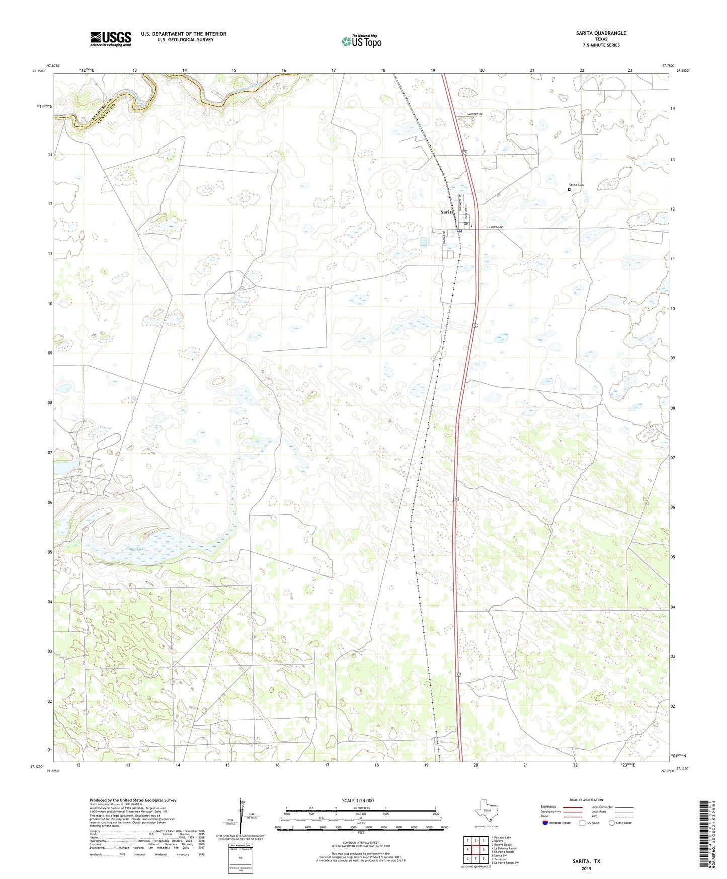
2022 topographic map quadrangle Sarita in the state of Texas. Scale: 1:24000. Based on the newly updated USGS 7.5' US Topo map series, this map is in the following counties: Kenedy, Kleberg. The map contains contour data, water features, and other items you are used to seeing on USGS maps, but also has updated roads and other features. This is the next generation of topographic maps. Printed on high-quality waterproof paper with UV fade-resistant inks.
Quads adjacent to this one:
West: La Paloma Ranch
Northwest: Paisano Lake
North: Riviera
Northeast: Riviera Beach
East: La Parra Ranch
Southeast: La Parra Ranch SW
South: Turcotte
Southwest: Sarita SW
This map covers the same area as the classic USGS quad with code o27097b7.
Contains the following named places: Casa Blanca Windmill, Cayo Lake, Cuatro de Julio Windmill, Kenedy County Jail, Kenedy County Sheriff's Office, Mantanza Well, Noria Vieja Well, Old Well Windmill, Paistle Windmill, Palo Blanco Creek, Palomas Windmill, Posta Windmill, Prieta Windmill, Rancho Verde Windmill, Sarita, Sarita Cemetery, Sarita Census Designated Place, Sarita Elementary School, Sarita Post Office, Tulitos Windmill, Turcotte Windmill