MyTopo
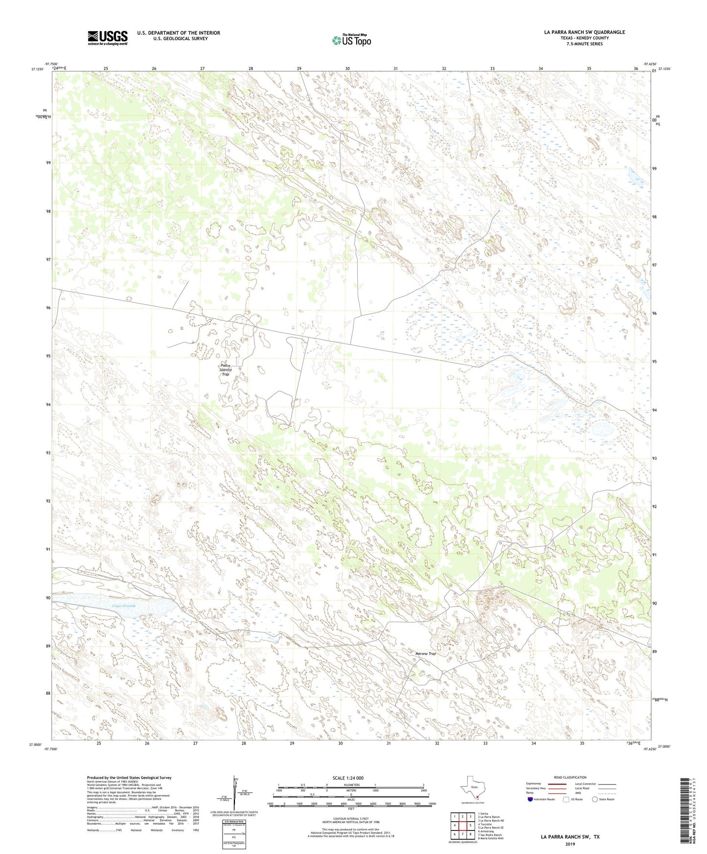
La Parra Ranch SW Texas US Topo Map
Couldn't load pickup availability
2022 topographic map quadrangle La Parra Ranch SW in the state of Texas. Scale: 1:24000. Based on the newly updated USGS 7.5' US Topo map series, this map is in the following counties: Kenedy. The map contains contour data, water features, and other items you are used to seeing on USGS maps, but also has updated roads and other features. This is the next generation of topographic maps. Printed on high-quality waterproof paper with UV fade-resistant inks.
Quads adjacent to this one:
West: Turcotte
Northwest: Sarita
North: La Parra Ranch
Northeast: La Parra Ranch NE
East: La Parra Ranch SE
Southeast: Maria Estella Well
South: San Pedro Ranch
Southwest: Armstrong
This map covers the same area as the classic USGS quad with code o27097a6.
Contains the following named places: Cayo Grande, Fence Martin Trap Windmill, Humble Oil Company Hub Number 1, Kennedy Lease Oil Well Number 1, Los Indios Artesian Well, Marana Artesian Well, Marana Camp, Marana Trap, Marcello Windmill, Mesquite Windmill, Mota Redonda Artesian Well, Motaralla Windmill, Padre Juanito Artesian Well, Padre Juanito Trap, Telefone Artesian Well, Tio Colas Artesian Well