MyTopo
Riviera Beach Texas US Topo Map
Couldn't load pickup availability
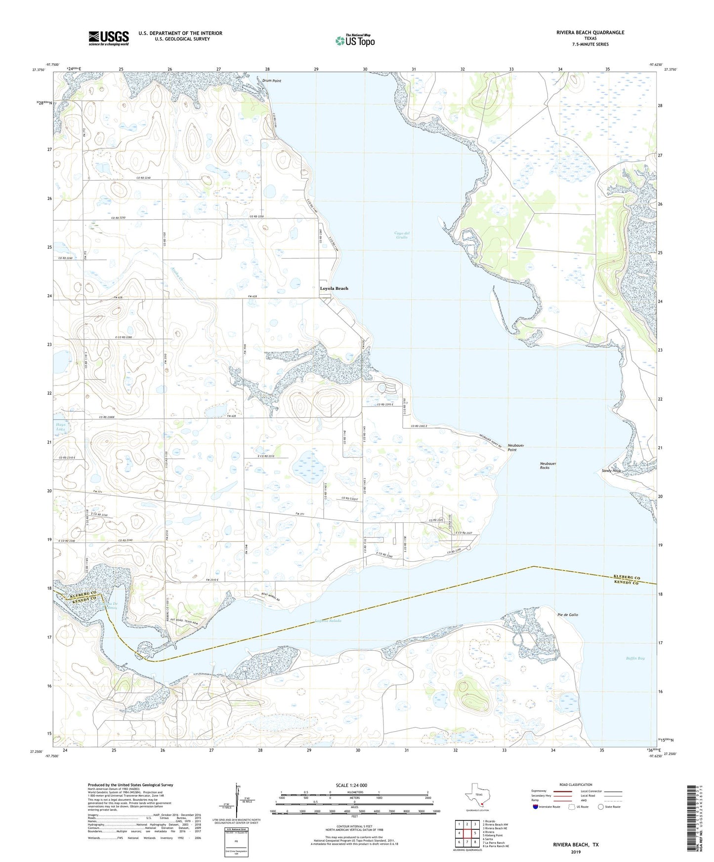
2022 topographic map quadrangle Riviera Beach in the state of Texas. Scale: 1:24000. Based on the newly updated USGS 7.5' US Topo map series, this map is in the following counties: Kleberg, Kenedy. The map contains contour data, water features, and other items you are used to seeing on USGS maps, but also has updated roads and other features. This is the next generation of topographic maps. Printed on high-quality waterproof paper with UV fade-resistant inks.
Quads adjacent to this one:
West: Riviera
Northwest: Ricardo
North: Riviera Beach NW
Northeast: Riviera Beach NE
East: Kleberg Point
Southeast: La Parra Ranch NE
South: La Parra Ranch
Southwest: Sarita
This map covers the same area as the classic USGS quad with code o27097c6.
Contains the following named places: Arana Creek, Cayo del Grullo, Drum Point, La Parra Landing, Laguna De Los Olmos, Laguna Salada, Las Puertas Artesian Well, Lorna Prieta Artesian Well, Los Olmos Creek, Loyola Beach, Neubauer Point, Neubauer Rock, Neubauer Rocks, Pie de Gallo, Riviera Beach, Sandy Hook, Vattman, Visnaga Well