MyTopo
Bangs East Texas US Topo Map
Couldn't load pickup availability
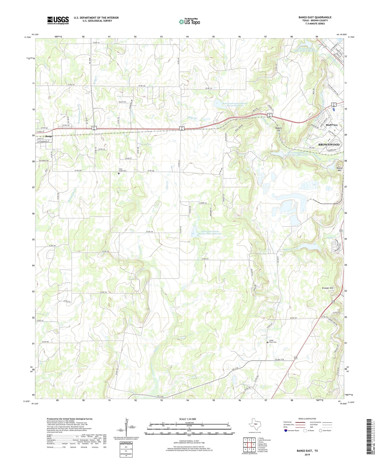
2022 topographic map quadrangle Bangs East in the state of Texas. Scale: 1:24000. Based on the newly updated USGS 7.5' US Topo map series, this map is in the following counties: Brown. The map contains contour data, water features, and other items you are used to seeing on USGS maps, but also has updated roads and other features. This is the next generation of topographic maps. Printed on high-quality waterproof paper with UV fade-resistant inks.
Quads adjacent to this one:
West: Bangs West
Northwest: Thrifty
North: Lake Brownwood
Northeast: Owens
East: Brownwood
Southeast: Indian Creek
South: Brookesmith
Southwest: Trickham
This map covers the same area as the classic USGS quad with code o31099f1.
Contains the following named places: Bluff View, Bluff View Drive-In, Boysen Cut, Brown County Sheriff's Office, Brownwood Fire Marshal's Office, Brownwood Oil Field, Brownwood Police Department, Brownwood Quarry, Brownwood Water Supply Canal, Cedar Point Cemetery, Childress Oil Field, Church of the Nazarene, Clear Creek Cemetery, Clear Creek Oil Field, Dalzell, Gravity, KBUB-FM (Brownwood), KOXE-FM (Brownwood), KPSM-FM (Brownwood), Krueger Hill, KXYL-FM (Brownwood), Round Mountain, Soil Conservation Service Site 1 Dam, Soil Conservation Service Site 1 Reservoir, Soil Conservation Service Site 2 Dam, Soil Conservation Service Site 2 Reservoir, Soil Conservation Service Site 2a Dam, Soil Conservation Service Site 2a Reservoir, Soil Conservation Service Site 3 Dam, Soil Conservation Service Site 3 Reservoir, Soil Conservation Service Site 5 Dam, Soil Conservation Service Site 5 Reservoir, Trigg Park, ZIP Code: 76801