MyTopo
Bangs West Texas US Topo Map
Couldn't load pickup availability
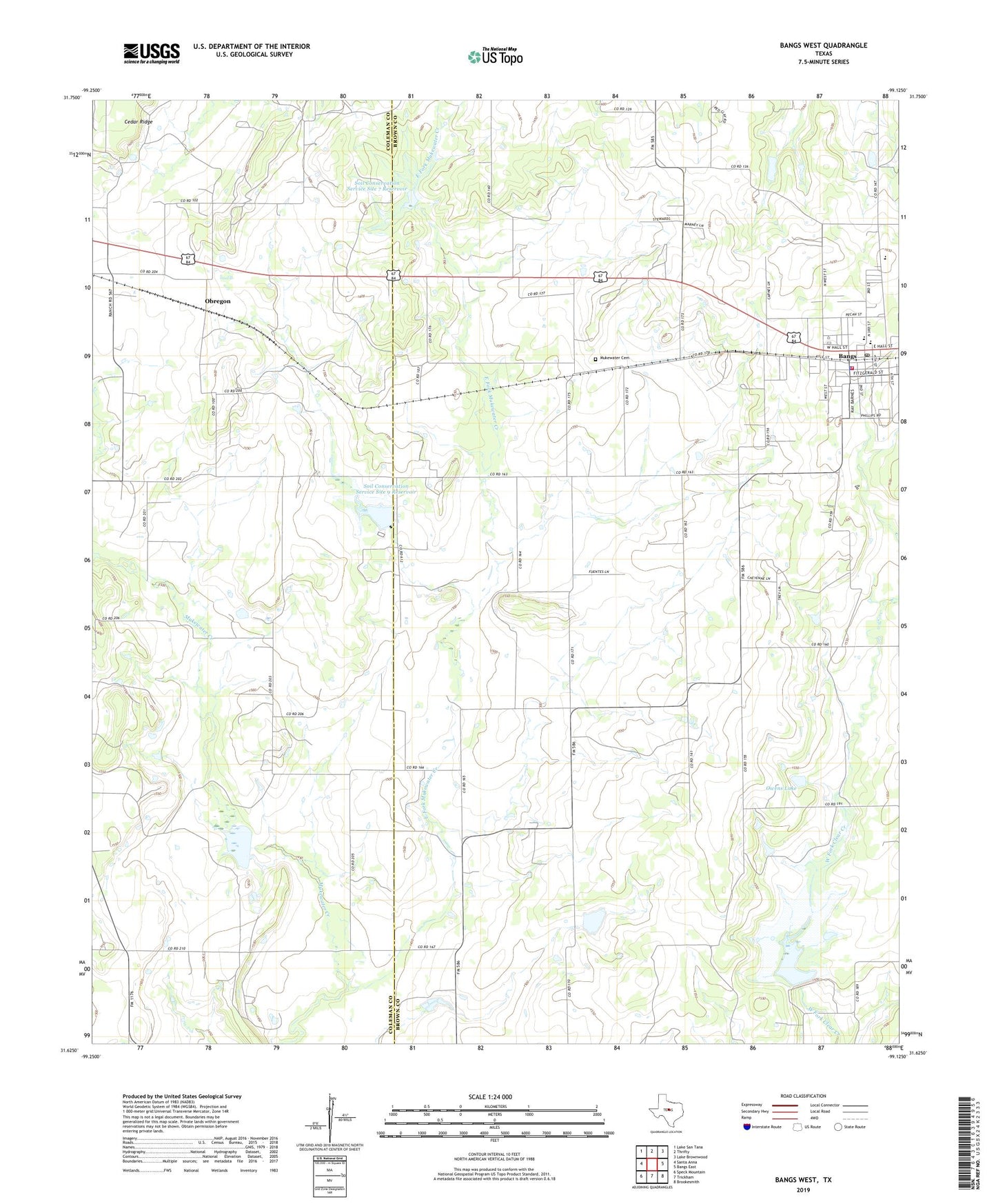
2022 topographic map quadrangle Bangs West in the state of Texas. Scale: 1:24000. Based on the newly updated USGS 7.5' US Topo map series, this map is in the following counties: Brown, Coleman. The map contains contour data, water features, and other items you are used to seeing on USGS maps, but also has updated roads and other features. This is the next generation of topographic maps. Printed on high-quality waterproof paper with UV fade-resistant inks.
Quads adjacent to this one:
West: Santa Anna
Northwest: Lake San Tana
North: Thrifty
Northeast: Lake Brownwood
East: Bangs East
Southeast: Brookesmith
South: Trickham
Southwest: Speck Mountain
This map covers the same area as the classic USGS quad with code o31099f2.
Contains the following named places: Bangs, Bangs Cemetery, Bangs City Hall, Bangs High School, Bangs Junior High School, Bangs Police Department, Bangs Post Office, Bangs Volunteer Fire Department, City of Bangs, Concord, Dragon Memorial Stadium, East Fork Mukewater Creek, J B Stephens Elementary School, Janellen Gas Field, Liberty, Mukewater Cemetery, Obregon, Owens Lake, Owens Lake Dam, Santa Anna Gas and Oil Field, Soil Conservation Service Site 10a Dam, Soil Conservation Service Site 10a Reservoir, Soil Conservation Service Site 4 Dam, Soil Conservation Service Site 4 Reservoir, Soil Conservation Service Site 7 Dam, Soil Conservation Service Site 7 Reservoir, Soil Conservation Service Site 9 Dam, Soil Conservation Service Site 9 Reservoir, ZIP Code: 76823