MyTopo
Lake Buchanan Texas US Topo Map
Couldn't load pickup availability
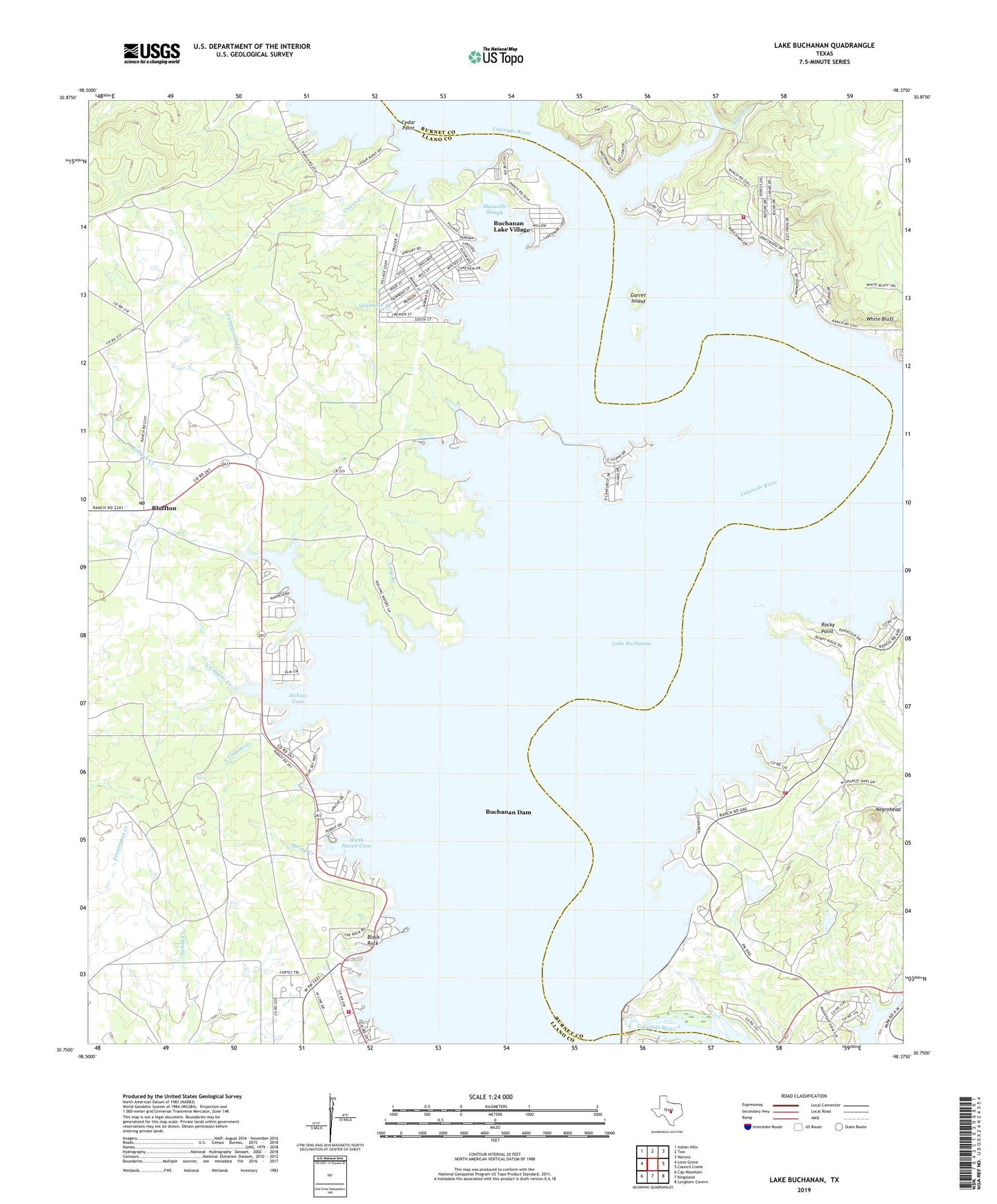
2019 topographic map quadrangle Lake Buchanan in the state of Texas. Scale: 1:24000. Based on the newly updated USGS 7.5' US Topo map series, this map is in the following counties: Llano, Burnet. The map contains contour data, water features, and other items you are used to seeing on USGS maps, but also has updated roads and other features. This is the next generation of topographic maps. Printed on high-quality waterproof paper with UV fade-resistant inks.
Quads adjacent to this one:
West: Lone Grove
Northwest: Indian Hills
North: Tow
Northeast: Naruna
East: Council Creek
Southeast: Longhorn Cavern
South: Kingsland
Southwest: Cap Mountain
Contains the following named places: Aero-Bee Ranch Airstrip, Alexander Branch, Beaver Creek, Bill Pickett Hill, Black Rock, Black Rock Park, Bluffton, Bluffton Post Office, Buchanan Dam, Buchanan Dam Census Designated Place, Buchanan Fire Department, Buchanan Lake Village, Buchanan Lake Village Census Designated Place, Burnet County Park, Campground Creek, Cassie Volunteer Fire Department, Cedar Point, Cedar Point Recreation Area Trail, Cowan Creek, East Lake Buchanan Fire Department, Garret Island, Golden Beach, Jeckers Cove, Lake Buchanan, Llano County Park, Long Branch, Lower Colorado River Authority Park, Maxwells Slough, North Coggins Creek, Redrock Creek, Rocky Point, Silver Creek, Silver Creek Village, South Coggins Creek, Spring Creek, White Bluff, Wirth Haven Cove, ZIP Codes: 78607, 78609, 78672