MyTopo
Cap Mountain Texas US Topo Map
Couldn't load pickup availability
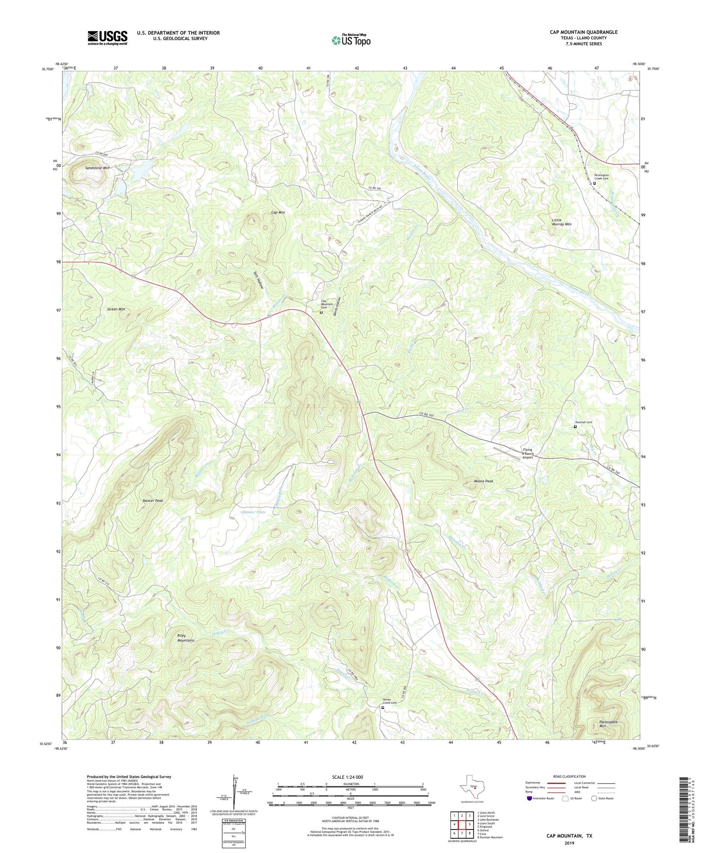
2022 topographic map quadrangle Cap Mountain in the state of Texas. Scale: 1:24000. Based on the newly updated USGS 7.5' US Topo map series, this map is in the following counties: Llano. The map contains contour data, water features, and other items you are used to seeing on USGS maps, but also has updated roads and other features. This is the next generation of topographic maps. Printed on high-quality waterproof paper with UV fade-resistant inks.
Quads adjacent to this one:
West: Llano South
Northwest: Llano North
North: Lone Grove
Northeast: Lake Buchanan
East: Kingsland
Southeast: Dunman Mountain
South: Click
Southwest: Oxford
This map covers the same area as the classic USGS quad with code o30098f5.
Contains the following named places: Bedford Creek, Cap Mountain, Cap Mountain Cemetery, Dancer Flats, Dancer Peak, Devils Hollow, Duncan Community Center, Flying H Ranch Airport, Gainesville, Granite Hills Ranch, Green Mountain, Honey Creek Cemetery, KLKM-FM (Llano), KLNO-TV (Llano), Little Murray Mountain, Molasses Creek, Moore Peak, Paschall Cemetery, Pennington Creek Cemetery, Rocky Creek, Salt Hollow, Sandstone Mountain, Straight Fork, Waters Creek