MyTopo
Lone Grove Texas US Topo Map
Couldn't load pickup availability
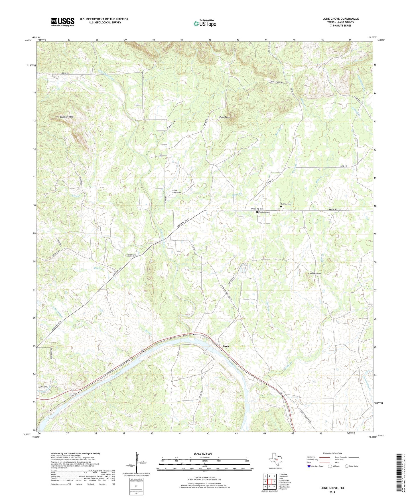
2022 topographic map quadrangle Lone Grove in the state of Texas. Scale: 1:24000. Based on the newly updated USGS 7.5' US Topo map series, this map is in the following counties: Llano. The map contains contour data, water features, and other items you are used to seeing on USGS maps, but also has updated roads and other features. This is the next generation of topographic maps. Printed on high-quality waterproof paper with UV fade-resistant inks.
Quads adjacent to this one:
West: Llano North
Northwest: Cherokee
North: Indian Hills
Northeast: Tow
East: Lake Buchanan
Southeast: Kingsland
South: Cap Mountain
Southwest: Llano South
This map covers the same area as the classic USGS quad with code o30098g5.
Contains the following named places: Bluffton Cemetery, Board Branch, Board Branch Cemetery, Cedar Hollow, Cowen Rocks, Flat Rock Cemetery, Harris Branch, Little Llano River, Little Sandy Creek, Lockhart Mountain, Lone Grove, Miller Creek, Mud Creek, Point Peak, Reed Creek, Stolz, Wrights Creek