MyTopo
Leagueville Texas US Topo Map
Couldn't load pickup availability
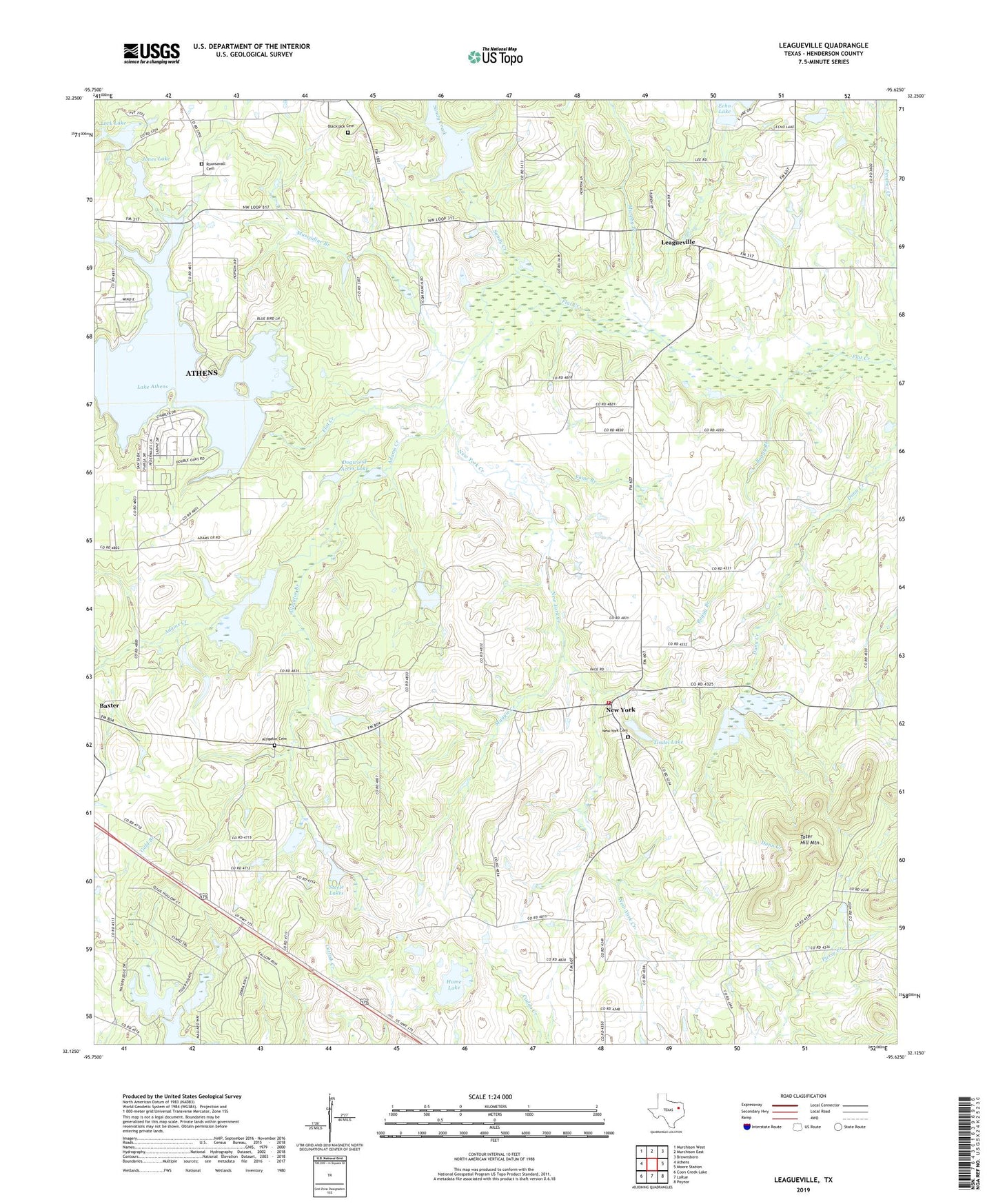
2019 topographic map quadrangle Leagueville in the state of Texas. Scale: 1:24000. Based on the newly updated USGS 7.5' US Topo map series, this map is in the following counties: Henderson. The map contains contour data, water features, and other items you are used to seeing on USGS maps, but also has updated roads and other features. This is the next generation of topographic maps. Printed on high-quality waterproof paper with UV fade-resistant inks.
Quads adjacent to this one:
West: Athens
Northwest: Murchison West
North: Murchison East
Northeast: Brownsboro
East: Moore Station
Southeast: Poynor
South: LaRue
Southwest: Coon Creek Lake
Contains the following named places: Adams Creek, Alligator Branch, Alligator Cemetery, Baxter, Bear Creek, Blackjack Cemetery, Boggy Branch, Dogwood Acres Lake, Dogwood Acres Lake Dam, Echo Lake Dam, Fame Branch, Farmer Lake, Harris Lake, Hume Lake, Jones Lake, Lake Athens, Lake Athens Dam, Larue - New York Volunteer Fire Department Substation, Leagueville, Lock Lake, Maggie Creek, Mount Zion Church, Murphy Branch, Muscadine Branch, New York, New York Baptist Church, New York Cemetery, New York Creek, Rounsavall Cemetery, Sandy Creek, Steele Lakes, Tater Hill Mountain, Tindel Lake, Tindel Lake Dam, ZIP Code: 75770