MyTopo
Poynor Texas US Topo Map
Couldn't load pickup availability
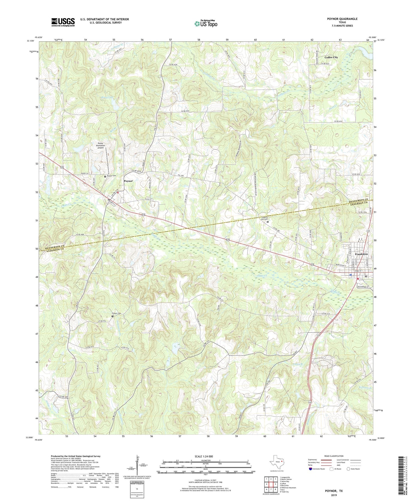
2022 topographic map quadrangle Poynor in the state of Texas. Scale: 1:24000. Based on the newly updated USGS 7.5' US Topo map series, this map is in the following counties: Anderson, Henderson. The map contains contour data, water features, and other items you are used to seeing on USGS maps, but also has updated roads and other features. This is the next generation of topographic maps. Printed on high-quality waterproof paper with UV fade-resistant inks.
Quads adjacent to this one:
West: LaRue
Northwest: Leagueville
North: Moore Station
Northeast: Saline Bay
East: Berryville
Southeast: Todd City
South: Pert
Southwest: Wilkerson Mountain
This map covers the same area as the classic USGS quad with code o32095a5.
Contains the following named places: Anderson County Constable's Office Precinct 3, First Baptist Church of Frankston, Foster Cemetery, Fosterville, Frankston, Frankston City Hall, Frankston Depot Library, Frankston Depot Museum, Frankston Fire Department, Frankston Police Department, Frankston Post Office, Henderson County Constable's Office Precinct 4, Kathleen C Fitzgerald Museum, Liberty Hill Cemetery, Liberty Hill Church, Mill Branch, Mixon Lake, Mixon Lake Dam, Myrtle Spring Church, Pickle Plantation Airport, Pine Spring Church, Pine Springs Baptist Church, Pleasant Hill School, Poynor, Poynor Cemetery, Poynor City Hall, Poynor Post Office, Poynor Volunteer Fire Department, Town of Frankston, Town of Poynor, ZIP Code: 75763