MyTopo
Leon Junction Texas US Topo Map
Couldn't load pickup availability
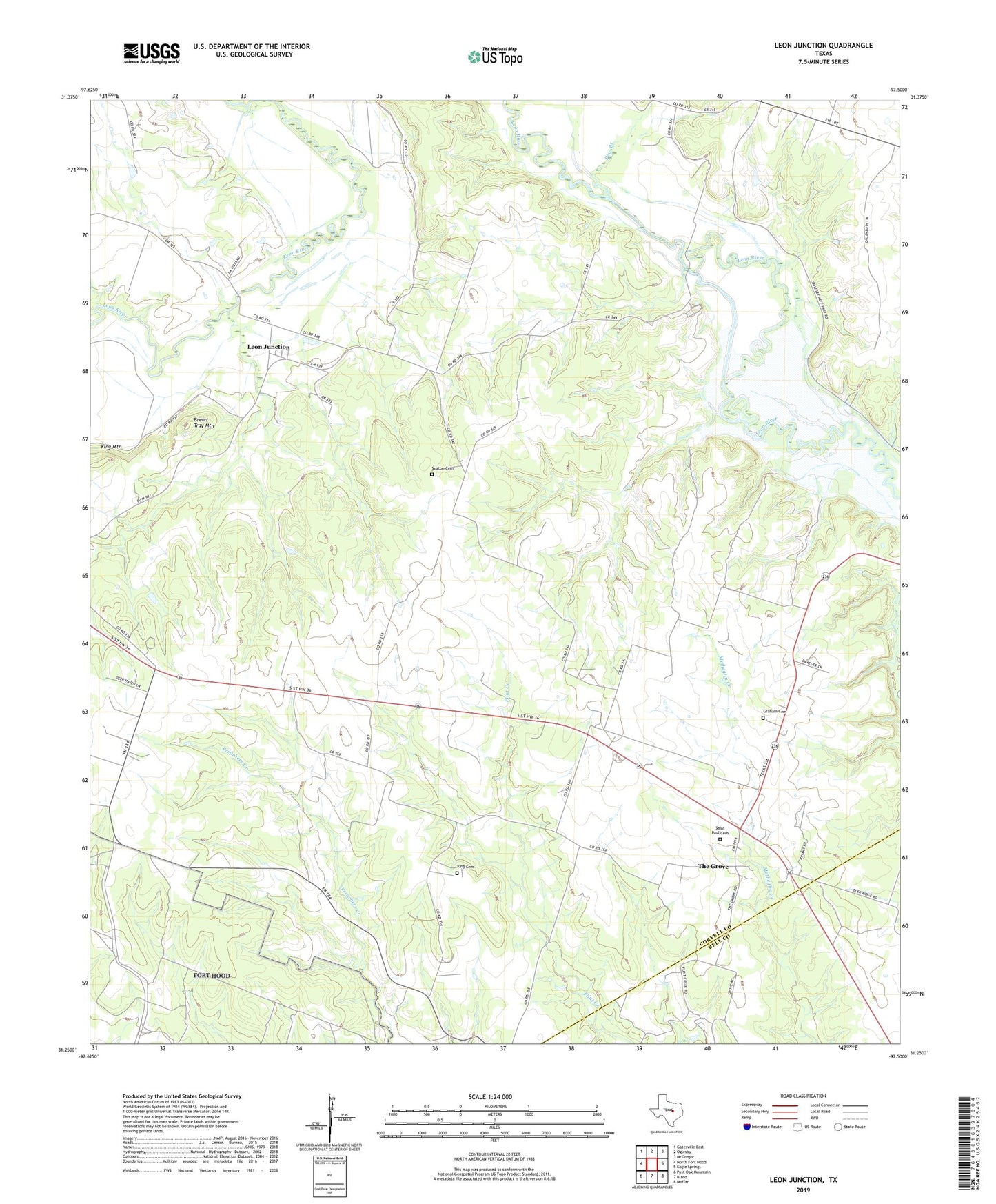
2019 topographic map quadrangle Leon Junction in the state of Texas. Scale: 1:24000. Based on the newly updated USGS 7.5' US Topo map series, this map is in the following counties: Coryell, Bell. The map contains contour data, water features, and other items you are used to seeing on USGS maps, but also has updated roads and other features. This is the next generation of topographic maps. Printed on high-quality waterproof paper with UV fade-resistant inks.
Quads adjacent to this one:
West: North Fort Hood
Northwest: Gatesville East
North: Oglesby
Northeast: McGregor
East: Eagle Springs
Southeast: Moffat
South: Bland
Southwest: Post Oak Mountain
Contains the following named places: Bread Tray Mountain, Cold Springs Church, Flat Census Designated Place, Flat Division, Flint Creek Cemetery, Graham Cemetery, Leon Junction, Leon Junction Community Church, Leon Junction School, Pew Branch, Saint Paul Cemetery, Saint Paul School, Seaton Cemetery, The Grove