MyTopo
Oglesby Texas US Topo Map
Couldn't load pickup availability
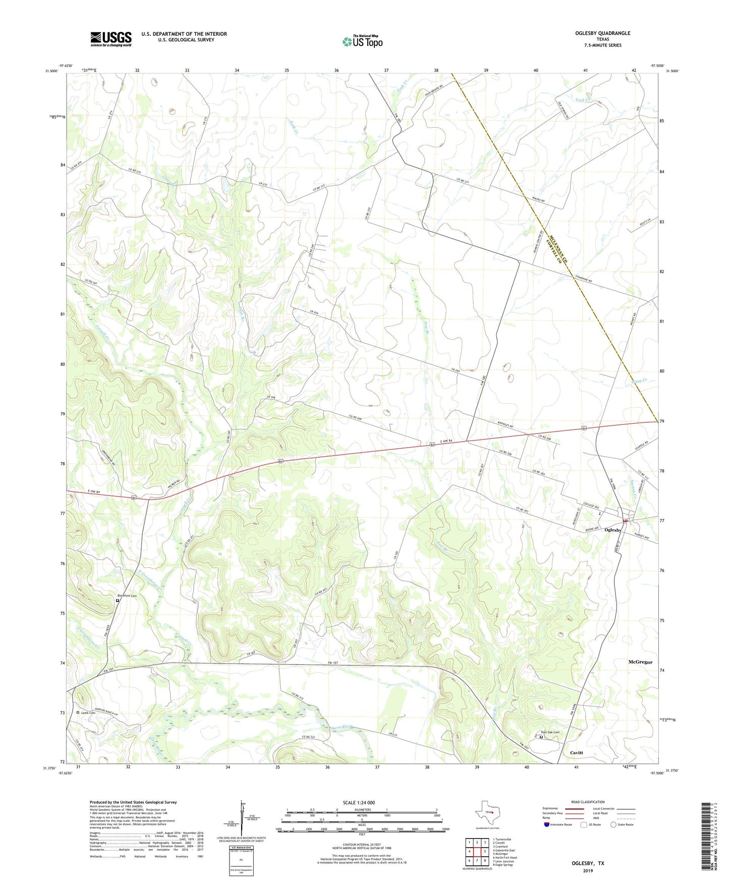
2022 topographic map quadrangle Oglesby in the state of Texas. Scale: 1:24000. Based on the newly updated USGS 7.5' US Topo map series, this map is in the following counties: Coryell, McLennan. The map contains contour data, water features, and other items you are used to seeing on USGS maps, but also has updated roads and other features. This is the next generation of topographic maps. Printed on high-quality waterproof paper with UV fade-resistant inks.
Quads adjacent to this one:
West: Gatesville East
Northwest: Turnersville
North: Coryell
Northeast: Crawford
East: McGregor
Southeast: Eagle Springs
South: Leon Junction
Southwest: North Fort Hood
This map covers the same area as the classic USGS quad with code o31097d5.
Contains the following named places: Blackfoot Cemetery, Cavitt, City of Oglesby, Clear Branch, Coryell Church, Coryell Creek, Lamb Cemetery, Lime City, Midway Drag Strip, North Greenbriar Creek, Oglesby, Oglesby City Hall, Oglesby Division, Oglesby Post Office, Oglesby Volunteer Fire Department and First Responder Organization, Pecan Grove, Pecan Grove Church, Post Oak Cemetery, South Greenbriar Creek, ZIP Code: 76561