MyTopo
Losoya Texas US Topo Map
Couldn't load pickup availability
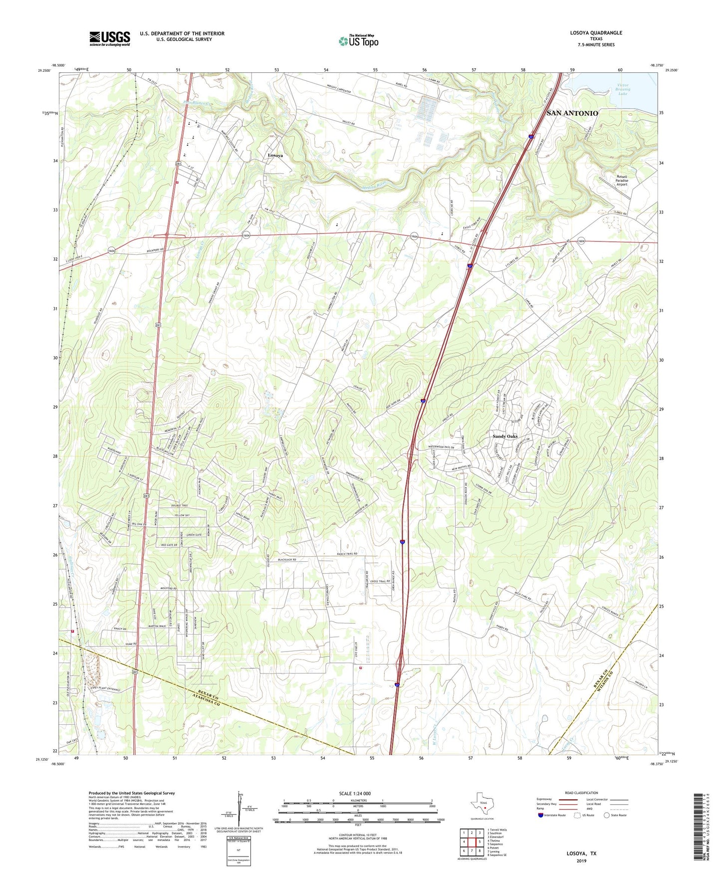
2022 topographic map quadrangle Losoya in the state of Texas. Scale: 1:24000. Based on the newly updated USGS 7.5' US Topo map series, this map is in the following counties: Bexar, Atascosa, Wilson. The map contains contour data, water features, and other items you are used to seeing on USGS maps, but also has updated roads and other features. This is the next generation of topographic maps. Printed on high-quality waterproof paper with UV fade-resistant inks.
Quads adjacent to this one:
West: Thelma
Northwest: Terrell Wells
North: Southton
Northeast: Elmendorf
East: Saspamco
Southeast: Saspamco SE
South: Leming
Southwest: Poteet
This map covers the same area as the classic USGS quad with code o29098b4.
Contains the following named places: A W Ranch Airport, Ata - Bexar County Line Volunteer Fire Department, Borregos Chapel, City of Sandy Oaks, El Carmen Church, Losoya, Losoya Creek, Losoya Intermediate School, Medina River, Mount Carmel Chapel, Our Lady of Mount Carmel Church, Palo Blanco Creek, Russell Paradise Airport, Sandy Oaks, Sandy Oaks Volunteer Fire Department, Shady Oak Baptist Church, Shady Oak Mission, South Bexar Volunteer Fire and Rescue Department, South Side High School, Southside Alternative Center, Southside Baptist Church, Southside Independent School District Police Department, Southside Middle School, Southside Stadium, Triple R Airport, W M Pearce Primary School, ZIP Codes: 78112, 78264