MyTopo
Lytton Springs Texas US Topo Map
Couldn't load pickup availability
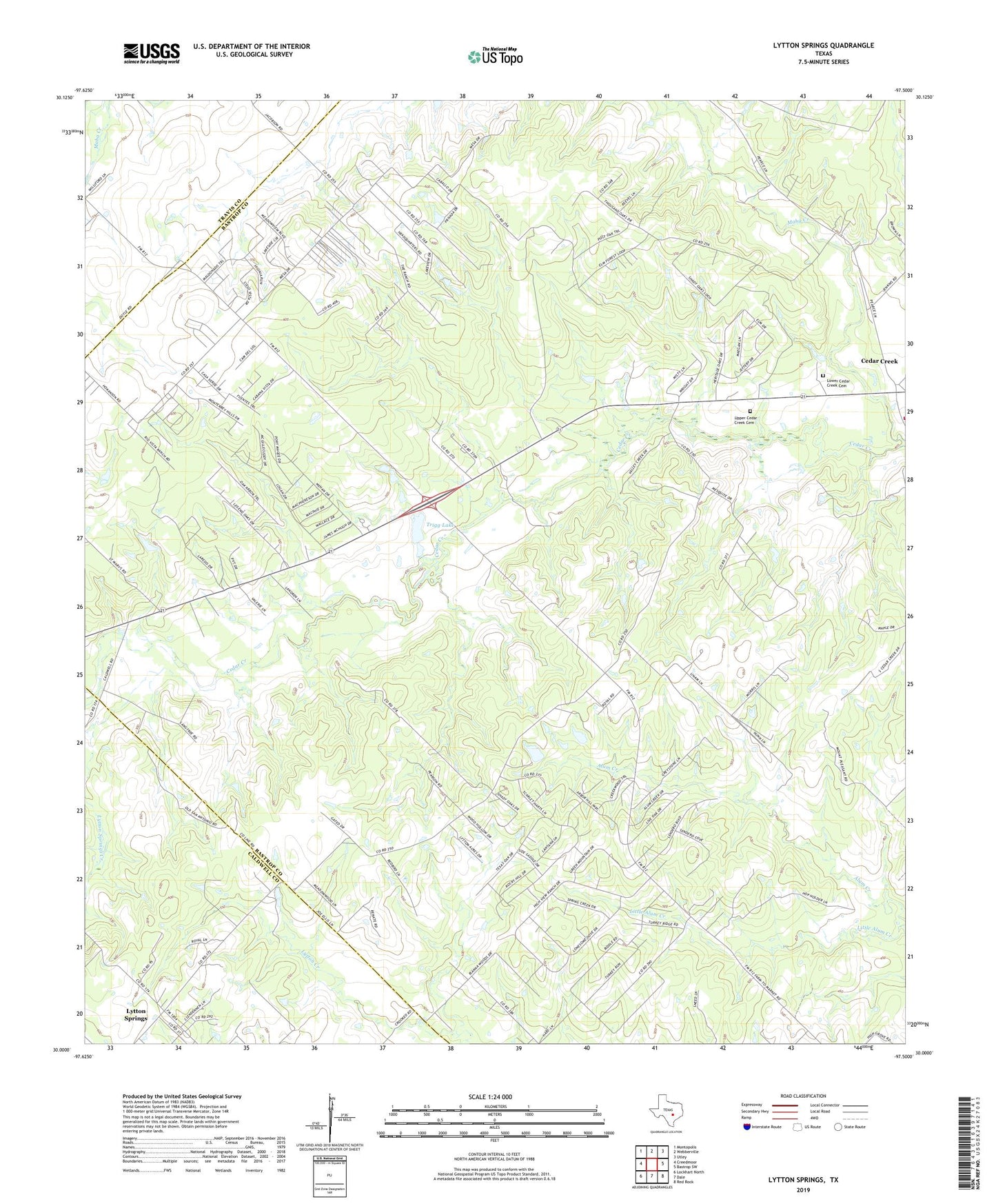
2019 topographic map quadrangle Lytton Springs in the state of Texas. Scale: 1:24000. Based on the newly updated USGS 7.5' US Topo map series, this map is in the following counties: Bastrop, Caldwell, Travis. The map contains contour data, water features, and other items you are used to seeing on USGS maps, but also has updated roads and other features. This is the next generation of topographic maps. Printed on high-quality waterproof paper with UV fade-resistant inks.
Quads adjacent to this one:
West: Creedmoor
Northwest: Montopolis
North: Webberville
Northeast: Utley
East: Bastrop SW
Southeast: Red Rock
South: Dale
Southwest: Lockhart North
Contains the following named places: Bastrop County Constable's Office Precinct 3, Cedar Creek, Cedar Creek Census Designated Place, Elroy Oil Field, KGSR-FM (Bastrop), Lower Cedar Creek Cemetery, Lytton Springs, Lytton Springs Creek, Mount Pleasant Church, Saint Marys Church, Saint Marys Community Center, Texas No Name Number 52 Dam, Trigg Lake, Trigg Lake Dam, Upper Cedar Creek Cemetery