MyTopo
Simpson Springs Mountain Texas US Topo Map
Couldn't load pickup availability
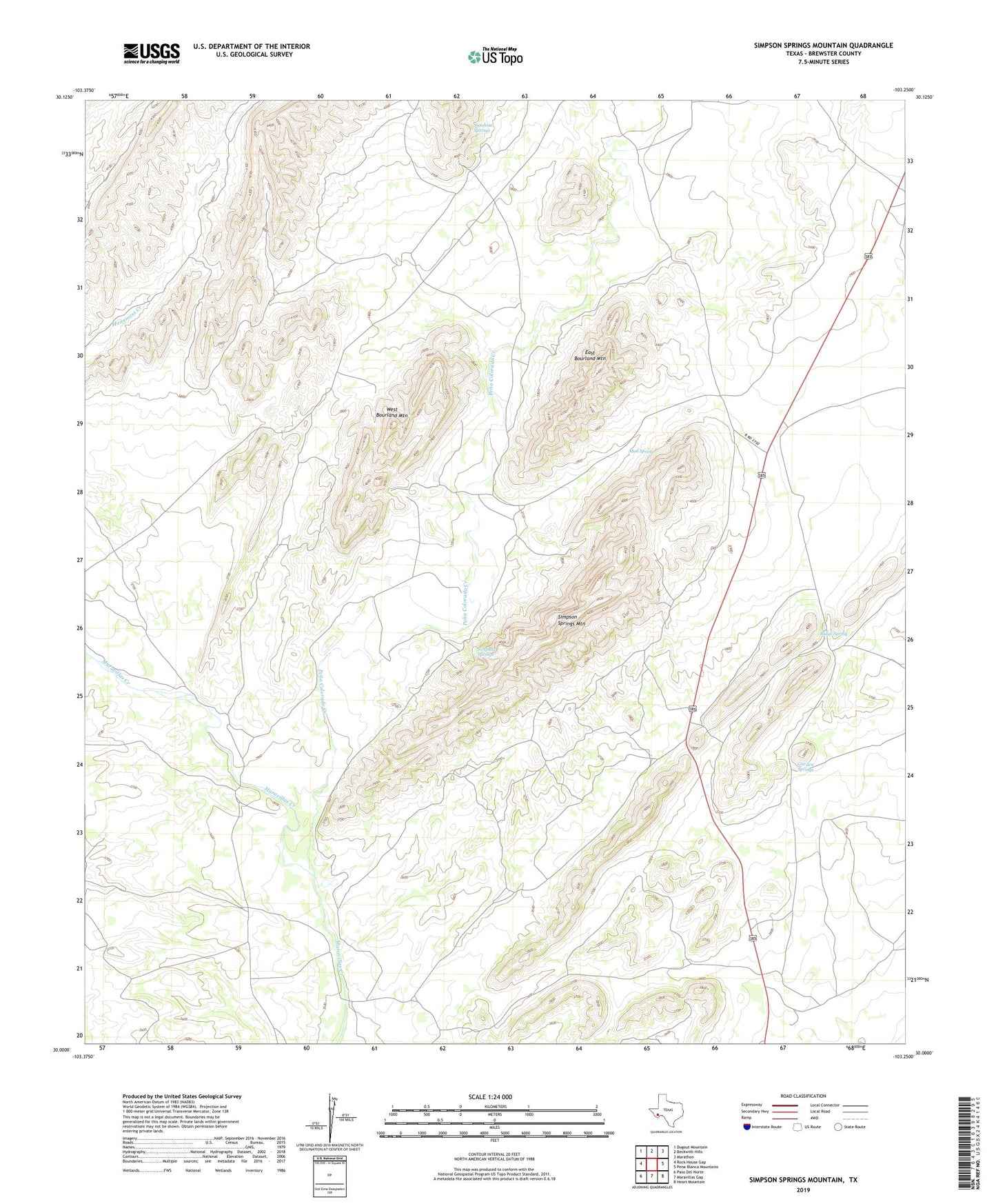
2022 topographic map quadrangle Simpson Springs Mountain in the state of Texas. Scale: 1:24000. Based on the newly updated USGS 7.5' US Topo map series, this map is in the following counties: Brewster. The map contains contour data, water features, and other items you are used to seeing on USGS maps, but also has updated roads and other features. This is the next generation of topographic maps. Printed on high-quality waterproof paper with UV fade-resistant inks.
Quads adjacent to this one:
West: Rock House Gap
Northwest: Dugout Mountain
North: Beckwith Hills
Northeast: Marathon
East: Pena Blanca Mountains
Southeast: Heart Mountain
South: Maravillas Gap
Southwest: Paso Del Norte
This map covers the same area as the classic USGS quad with code o30103a3.
Contains the following named places: Bourland Ranch, Combs Headquarters Ranch, East Bourland Mountain, Garden Springs, Mud Spring, Pena Colorado Creek, Ridge Spring, Simpson Springs, Simpson Springs Mountain, Sunshine Springs, West Bourland Mountain