MyTopo
Marcado Creek Texas US Topo Map
Couldn't load pickup availability
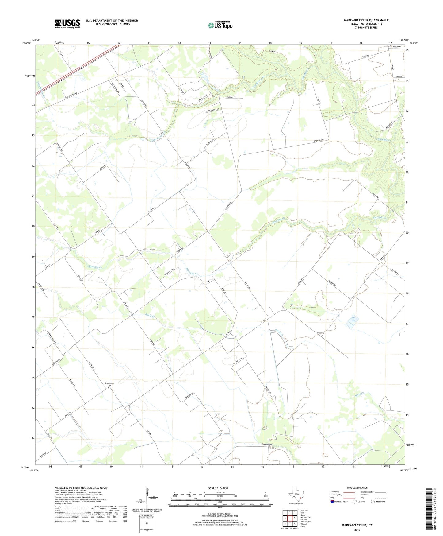
2022 topographic map quadrangle Marcado Creek in the state of Texas. Scale: 1:24000. Based on the newly updated USGS 7.5' US Topo map series, this map is in the following counties: Victoria. The map contains contour data, water features, and other items you are used to seeing on USGS maps, but also has updated roads and other features. This is the next generation of topographic maps. Printed on high-quality waterproof paper with UV fade-resistant inks.
Quads adjacent to this one:
West: Victoria East
Northwest: Inez NW
North: Inez
Northeast: Edna
East: La Salle
Southeast: Kamey
South: Placedo
Southwest: Bloomington
This map covers the same area as the classic USGS quad with code o28096g7.
Contains the following named places: Casa Blanca Creek, Inez Census Designated Place, Shillerville Cemetery, William Wood Elementary School, Wood Hi, Wood High School