MyTopo
Inez Texas US Topo Map
Couldn't load pickup availability
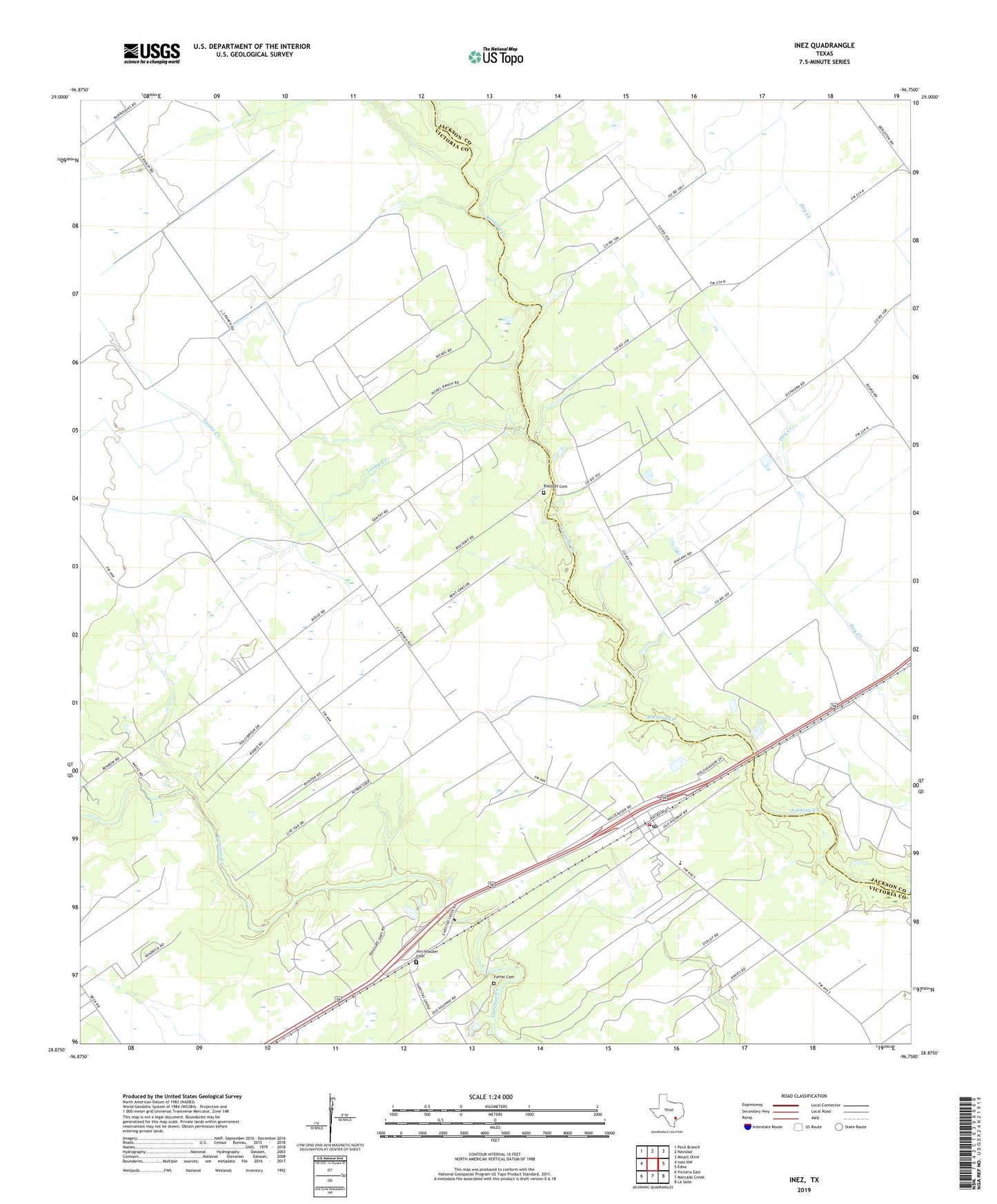
2022 topographic map quadrangle Inez in the state of Texas. Scale: 1:24000. Based on the newly updated USGS 7.5' US Topo map series, this map is in the following counties: Victoria, Jackson. The map contains contour data, water features, and other items you are used to seeing on USGS maps, but also has updated roads and other features. This is the next generation of topographic maps. Printed on high-quality waterproof paper with UV fade-resistant inks.
Quads adjacent to this one:
West: Inez NW
Northwest: Peck Branch
North: Navidad
Northeast: Mount Olive
East: Edna
Southeast: La Salle
South: Marcado Creek
Southwest: Victoria East
This map covers the same area as the classic USGS quad with code o28096h7.
Contains the following named places: Arenosa School, Bischoff Cemetery, Farrer Cemetery, Hirchhauser Cemetery, Inez, Inez Elementary School, Inez Fire Department, Inez Post Office, Leona Creek, ZIP Code: 77968