MyTopo
Neches Texas US Topo Map
Couldn't load pickup availability
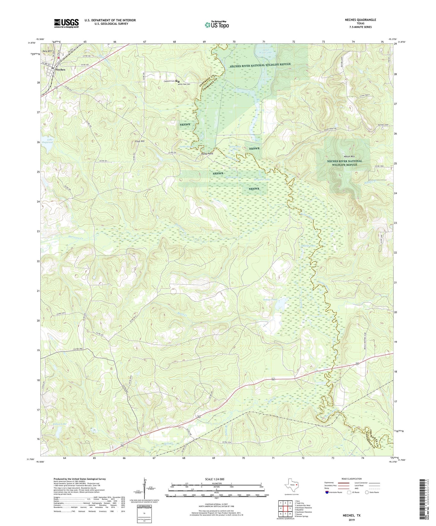
2022 topographic map quadrangle Neches in the state of Texas. Scale: 1:24000. Based on the newly updated USGS 7.5' US Topo map series, this map is in the following counties: Anderson, Cherokee. The map contains contour data, water features, and other items you are used to seeing on USGS maps, but also has updated roads and other features. This is the next generation of topographic maps. Printed on high-quality waterproof paper with UV fade-resistant inks.
Quads adjacent to this one:
West: Northeast Palestine
Northwest: Pert
North: Todd City
Northeast: Jacksonville West
East: Maydelle
Southeast: Denson Springs
South: Slocum
Southwest: Southeast Palestine
This map covers the same area as the classic USGS quad with code o31095g4.
Contains the following named places: Alligator Lake, Antioch Church, Beech Creek, Black Lake, Buzzard Slough, Caldwell Cemetery, Daly Mountain, Dead Water Lake, Fields Chapel, Flint Hill, Flint Hill Church, Flint Hill School, Herring, Horseshoe Lake, Hurricane Creek, Indian Pond, Jarvis, Killion Lake, Killon Lake Dam, Lake Dogwood, Lake Dogwood Dam, Neches, Neches Census Designated Place, Neches Post Office, Neches Volunteer Fire Department, Phillips Lake, Rocky Point, Saint Johns Church, Stills Creek, Sumac Branch, Turtle Slough, Twin Lakes, Watts School, White Mountain, White Oak Cemetery, White Oak Creek, ZIP Code: 75779