MyTopo
Todd City Texas US Topo Map
Couldn't load pickup availability
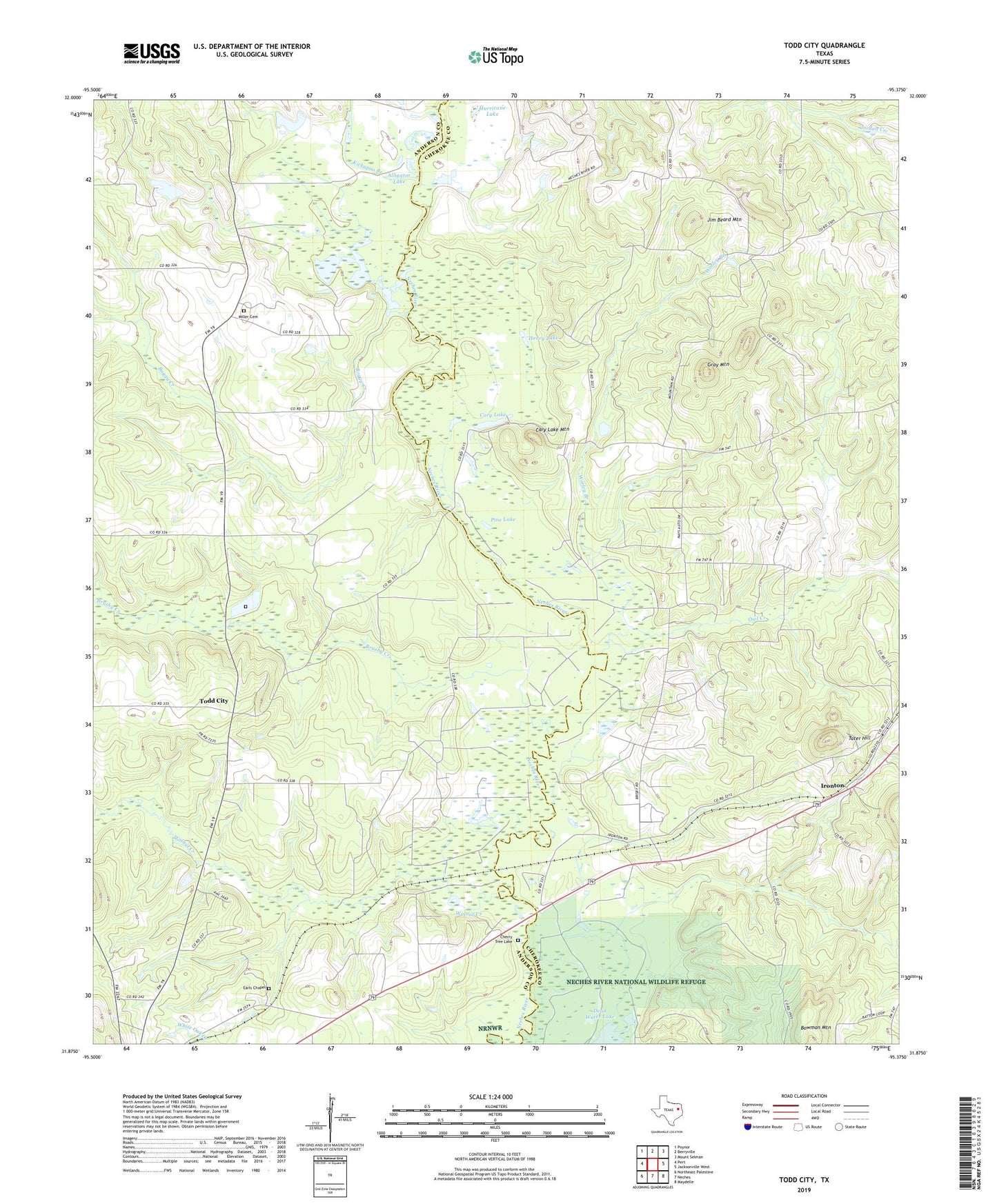
2022 topographic map quadrangle Todd City in the state of Texas. Scale: 1:24000. Based on the newly updated USGS 7.5' US Topo map series, this map is in the following counties: Cherokee, Anderson. The map contains contour data, water features, and other items you are used to seeing on USGS maps, but also has updated roads and other features. This is the next generation of topographic maps. Printed on high-quality waterproof paper with UV fade-resistant inks.
Quads adjacent to this one:
West: Pert
Northwest: Poynor
North: Berryville
Northeast: Mount Selman
East: Jacksonville West
Southeast: Maydelle
South: Neches
Southwest: Northeast Palestine
This map covers the same area as the classic USGS quad with code o31095h4.
Contains the following named places: Alligator Lake, Boggy Creek, Bowman Mountain, Brisby Chapel, Brushy Creek, Cary Lake, Cary Lake Mountain, Cherry Tree Lake, Clemons School, Corine, Corine School, Earls Chapel, Gray Mountain, Greens Chapel School, Henry Lake, Hollywood School, Hurricane Lake, Jim Beard Mountain, Kickapoo Branch, Miller Cemetery, Neches Gas Plant, Neches Oil Field, Neches River National Wildlife Refuge, Owl Creek, Pierces Chapel, Pine Lake, Prices, Simpson Branch, Tater Hill, Todd City, Todd City Oil Field, Todd Pond, Twin Lakes, Walnut Creek, Worley Branch