MyTopo
Lone Oak North Texas US Topo Map
Couldn't load pickup availability
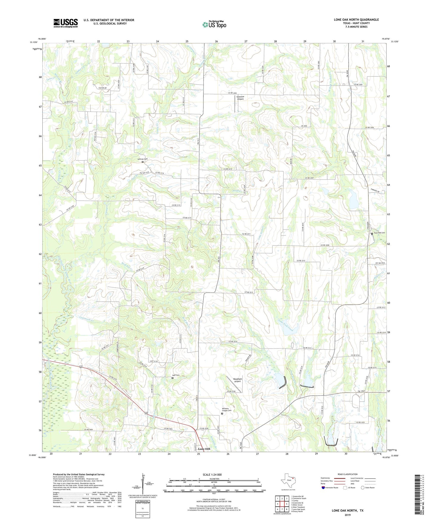
2022 topographic map quadrangle Lone Oak North in the state of Texas. Scale: 1:24000. Based on the newly updated USGS 7.5' US Topo map series, this map is in the following counties: Hunt. The map contains contour data, water features, and other items you are used to seeing on USGS maps, but also has updated roads and other features. This is the next generation of topographic maps. Printed on high-quality waterproof paper with UV fade-resistant inks.
Quads adjacent to this one:
West: Greenville SE
Northwest: Greenville NE
North: Commerce South
Northeast: Cumby
East: Miller Grove
Southeast: Emory North
South: Lone Oak South
Southwest: West Tawakoni
This map covers the same area as the classic USGS quad with code o33095a8.
Contains the following named places: Caney Church, Caney Creek, Cowmiech Creek, Dam Number 2, Dam Number 3, Dam Number 4, Dunbar School, Glenmar Airport, Hall Cemetery, Head Creek, Lone Oak Division, Lynn Creek, Plainview Church, Pool Branch, Prairie Valley Church, Soil Conservation Service Site 1 Dam, Soil Conservation Service Site 1 Reservoir, Soil Conservation Service Site 10a Dam, Soil Conservation Service Site 10a Reservoir, Soil Conservation Service Site 2 Dam, Soil Conservation Service Site 2 Reservoir, Soil Conservation Service Site 3 Dam, Soil Conservation Service Site 3 Reservoir, Soil Conservation Service Site 4 Dam, Soil Conservation Service Site 4 Reservoir, Sullivan Cemetery, Twin Oak Cemetery, Watson Branch, Weedfalls Airport, West Caney Creek, Williams Chapel Cemetery, Wolf Pen Creek