MyTopo
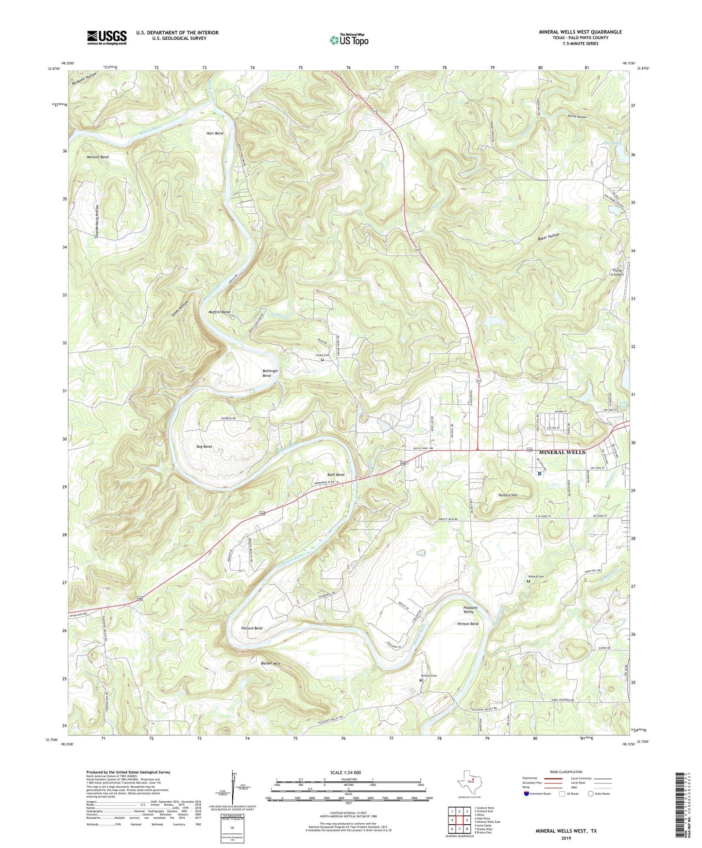
Mineral Wells West Texas US Topo Map
Couldn't load pickup availability
2019 topographic map quadrangle Mineral Wells West in the state of Texas. Scale: 1:24000. Based on the newly updated USGS 7.5' US Topo map series, this map is in the following counties: Palo Pinto. The map contains contour data, water features, and other items you are used to seeing on USGS maps, but also has updated roads and other features. This is the next generation of topographic maps. Printed on high-quality waterproof paper with UV fade-resistant inks.
Quads adjacent to this one:
West: Palo Pinto
Northwest: Graford West
North: Graford East
Northeast: Whitt
East: Mineral Wells East
Southeast: Brazos East
South: Brazos West
Southwest: Lone Camp
Contains the following named places: Air Evac Lifeteam 55, Baker Hollow, Ballenger Bend, Barber Mountain, Bath Bend, Birdwell Hollow, Coronados Camp, Dike Lake, Dike Lake Dam, Dog Bend, Elmhurst Park, Griffin Cemetery, Hart Bend, Hittson Bend, Hittson Cemetery, Indian Creek, Indian Creek Cemetery, Jones Hollow, Keechi Creek, Lake Pinto, Locke Cemetery, Metcalf Bend, Miller Stadium, Mineral Wells Division, Mineral Wells Park, Moffitt Bend, Palo Pinto General Hospital, Palo Pinto General Hospital Heliport, Pleasant Valley, Pollard Bend, Pollard Creek, Pollard Hill, Thunderburg Hollow, Turkey Creek, Whatley Creek, Wilson Lake, Wilson Lake Dam, ZIP Code: 76067