MyTopo
Lone Camp Texas US Topo Map
Couldn't load pickup availability
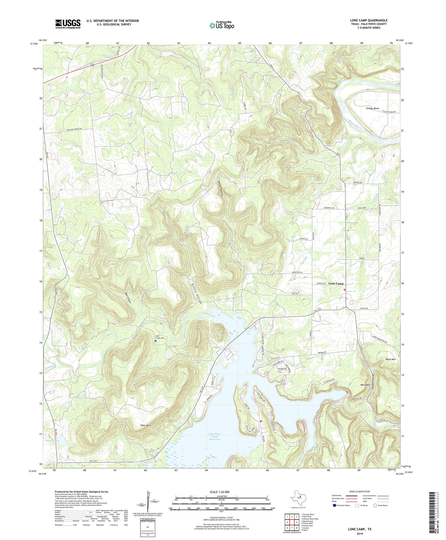
2022 topographic map quadrangle Lone Camp in the state of Texas. Scale: 1:24000. Based on the newly updated USGS 7.5' US Topo map series, this map is in the following counties: Palo Pinto. The map contains contour data, water features, and other items you are used to seeing on USGS maps, but also has updated roads and other features. This is the next generation of topographic maps. Printed on high-quality waterproof paper with UV fade-resistant inks.
Quads adjacent to this one:
West: Metcalf Gap
Northwest: Fortune Bend
North: Palo Pinto
Northeast: Mineral Wells West
East: Brazos West
Southeast: Santo
South: Gordon
Southwest: Strawn East
This map covers the same area as the classic USGS quad with code o32098f3.
Contains the following named places: Bear Canyon, Gordon Oil Field, Hittson Hollow, Honey Creek, Joes Creek, Johnson Lake, Johnson Lake Dam, Kettle Hollow, Lake Creek, Lake Creek Cemetery, Lake Palo Pinto, Lake Palo Pinto Dam, Lake Palo Pinto Volunteer Fire Department, Lone Camp, Lone Camp Baptist Church, Lone Camp Volunteer Fire Department and First Responders, Palo Pinto Creek Reservoir, Ringo Lake, Ringo Lake Dam, Village Bend, Ward Mountain, Ward Mountain Church, Whit Mountain, Wilson Hollow