MyTopo
Graford East Texas US Topo Map
Couldn't load pickup availability
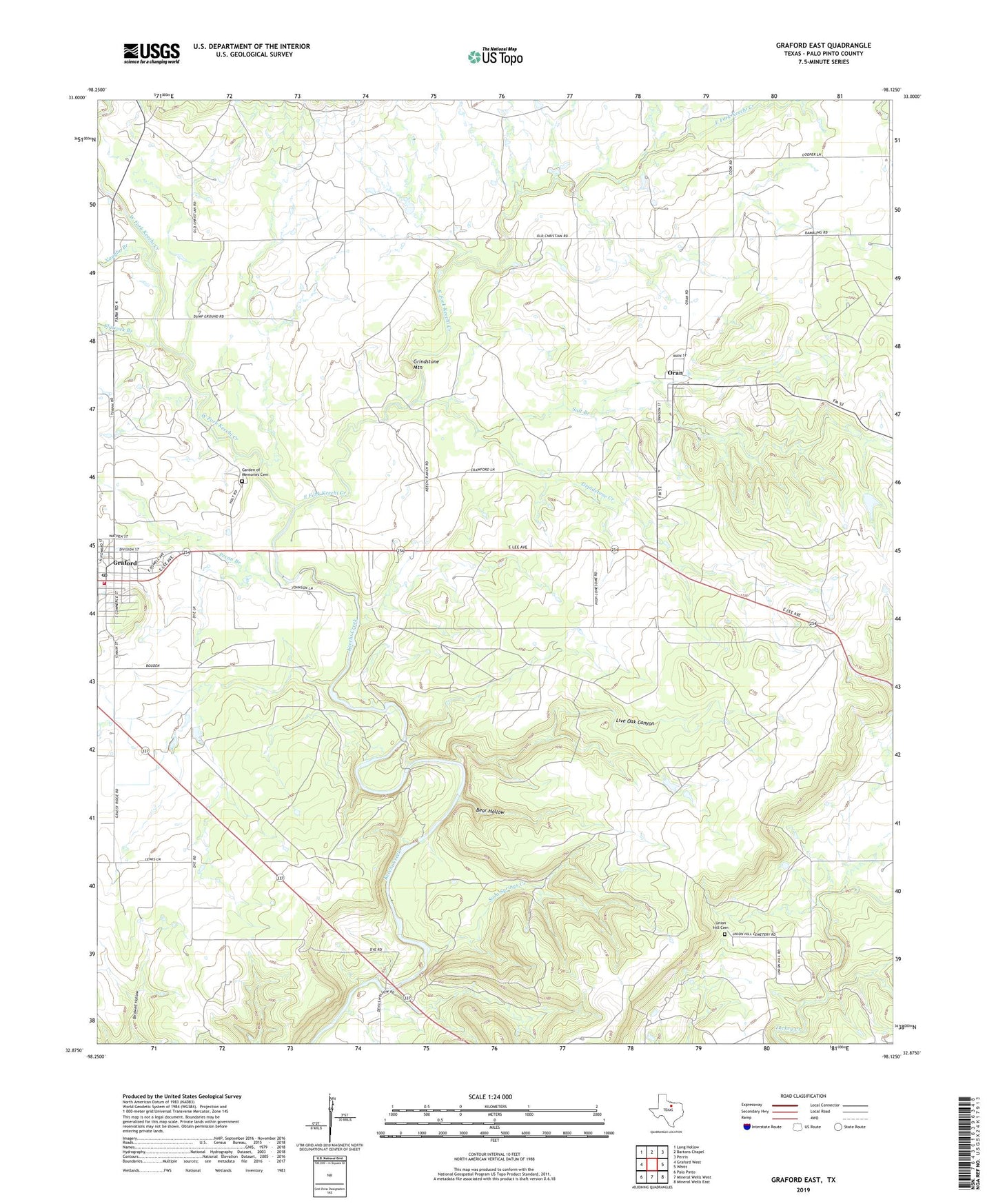
2022 topographic map quadrangle Graford East in the state of Texas. Scale: 1:24000. Based on the newly updated USGS 7.5' US Topo map series, this map is in the following counties: Palo Pinto. The map contains contour data, water features, and other items you are used to seeing on USGS maps, but also has updated roads and other features. This is the next generation of topographic maps. Printed on high-quality waterproof paper with UV fade-resistant inks.
Quads adjacent to this one:
West: Graford West
Northwest: Long Hollow
North: Bartons Chapel
Northeast: Perrin
East: Whitt
Southeast: Mineral Wells East
South: Mineral Wells West
Southwest: Palo Pinto
This map covers the same area as the classic USGS quad with code o32098h2.
Contains the following named places: Bear Hollow, City of Graford, East Fork Keechi Creek, Flatrock Branch, Garden of Memories Cemetery, Graford, Graford City Hall, Graford Fire Department, Graford Post Office, Grindstone Creek, Grindstone Mountain, Live Oak Canyon, Oran, Pecan Branch, Salt Branch, Soda Springs Creek, Union Hill Cemetery, Vaughn Branch, West Fork Keechi Creek