MyTopo
Brazos West Texas US Topo Map
Couldn't load pickup availability
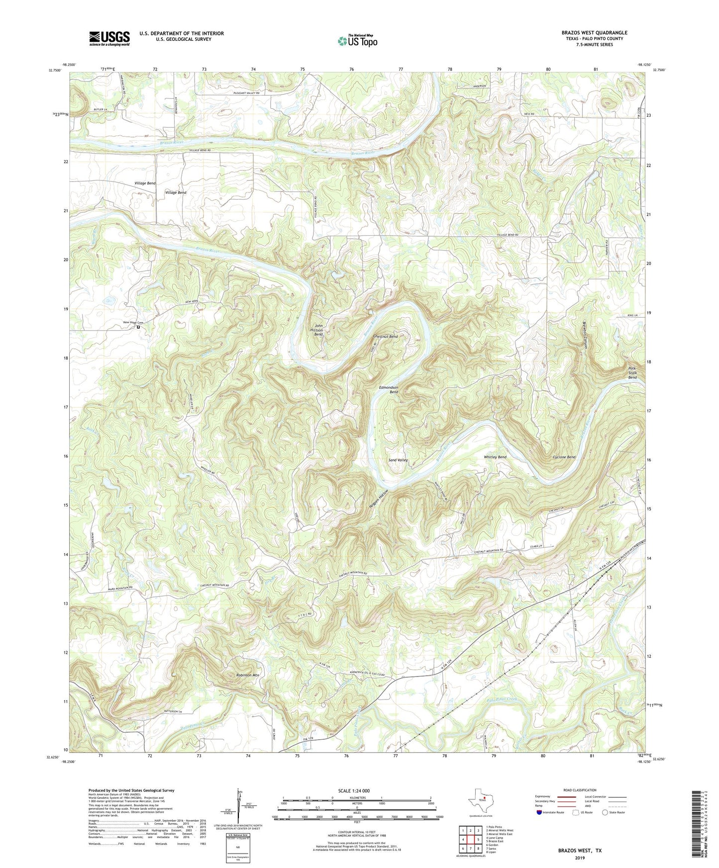
2022 topographic map quadrangle Brazos West in the state of Texas. Scale: 1:24000. Based on the newly updated USGS 7.5' US Topo map series, this map is in the following counties: Palo Pinto. The map contains contour data, water features, and other items you are used to seeing on USGS maps, but also has updated roads and other features. This is the next generation of topographic maps. Printed on high-quality waterproof paper with UV fade-resistant inks.
Quads adjacent to this one:
West: Lone Camp
Northwest: Palo Pinto
North: Mineral Wells West
Northeast: Mineral Wells East
East: Brazos East
Southeast: Lipan
South: Santo
Southwest: Gordon
This map covers the same area as the classic USGS quad with code o32098f2.
Contains the following named places: Baker Creek, Brewton Canyon, Buck Creek, Chestnut Bend, Cyclone Bend, Dry Branch, Edmondson Bend, Hogpen Hollow, John Hittson Bend, Matthews Ranch Airport, New Hope Cemetery, Palo Pinto Creek Diversion Dam, Palo Pinto-Santo Division, Pleasant Valley Church, Polk Stalk Bend, Progress School, Robinson Mountain, Rock Creek, Sand Valley, Village Bend, Ward Branch, Whitley Bend, Willow Pond Church, Worser Creek