MyTopo
Brazos East Texas US Topo Map
Couldn't load pickup availability
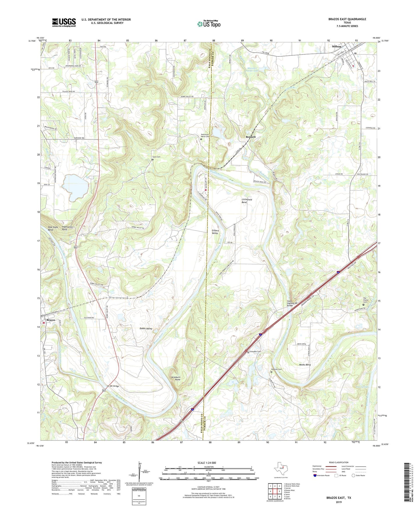
2022 topographic map quadrangle Brazos East in the state of Texas. Scale: 1:24000. Based on the newly updated USGS 7.5' US Topo map series, this map is in the following counties: Parker, Palo Pinto. The map contains contour data, water features, and other items you are used to seeing on USGS maps, but also has updated roads and other features. This is the next generation of topographic maps. Printed on high-quality waterproof paper with UV fade-resistant inks.
Quads adjacent to this one:
West: Brazos West
Northwest: Mineral Wells West
North: Mineral Wells East
Northeast: Garner
East: Brock
Southeast: Dennis
South: Lipan
Southwest: Santo
This map covers the same area as the classic USGS quad with code o32098f1.
Contains the following named places: Arteburn Point, Bennett, Brannon Cemetery, Brazos, Brazos Census Designated Place, Brazos Volunteer Fire Department, Brock Elementary School, Brock High School, Dobbs Valley, Dominicar Merlo Cemetery, Fairview Church, Gilbert Valley, Goen Cemetery, Grassdale Cemetery, Grassy Branch, Grindstone Creek, Highway Church, Hill Creek, Inspiration Point, Jones Springs, Littlefield Bend, Meeks Bend, Millsap, Millsap Cemetery, Millsap City Hall, Millsap Post Office, Millsap United Methodist Church, Missouri Pacific Dam, Missouri Pacific Lake, Mountain River Volunteer Fire Department, Palo Pinto Creek, Poe Prairie Cemetery, Rock Creek, Soda Springs Baptist Church, Soda Springs Cemetery, Soda Springs Church, State Highway 89 Bridge, Town of Millsap, US 281 Bridge, Weatherford Quarry