MyTopo
Montgomery Texas US Topo Map
Couldn't load pickup availability
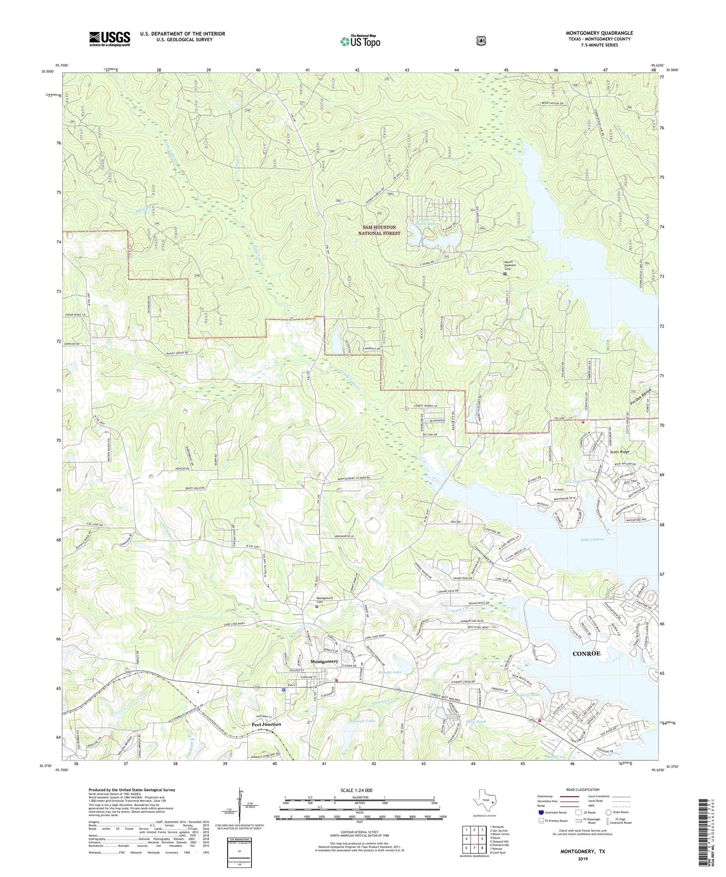
2019 topographic map quadrangle Montgomery in the state of Texas. Scale: 1:24000. Based on the newly updated USGS 7.5' US Topo map series, this map is in the following counties: Montgomery. The map contains contour data, water features, and other items you are used to seeing on USGS maps, but also has updated roads and other features. This is the next generation of topographic maps. Printed on high-quality waterproof paper with UV fade-resistant inks.
Quads adjacent to this one:
West: Dacus
Northwest: Richards
North: San Jacinto
Northeast: Moore Grove
East: Shepard Hill
Southeast: Cowl Spur
South: Keenan
Southwest: Plantersville
Contains the following named places: Arnold-Simonton House, Brownwood Church, Caney Creek, Cape Conroe Dam Number 1, Carwile Creek, China Chapel, Circle V Ranch, City of Montgomery, Flamingo Lake Number 1 Dam, Fling Pond, Hidden Forest Lake, Hidden Forest Lake Dam, Lake Mount Pleasant, Lincoln School, Little Lake Creek, Little Lake Creek Wilderness, Martin Creek, Montgomery, Montgomery Cemetery, Montgomery City Hall, Montgomery Division, Montgomery Elementary School, Montgomery Fire Department Station 51, Montgomery Fire Department Station 55, Montgomery High School, Montgomery Junior High School, Montgomery Police Department, Montgomery Post Office, Montgomery United Methodist Church, Mount Pleasant Cemetery, Mount Pleasant Church, Mount Pleasant Lake Dam, Peel Cabin, Peel Junction, Peel Lake, Pole Creek, Rampy Lake, Rampy Lake Dam, Sand Branch, Scott Ridge, Scott Ridge Church, Scotts Ridge Recreation Site, Stanley Lake, Stewart Creek, Stewart Lake, Stewart Lake Dam, Town Creek, ZIP Code: 77356