MyTopo
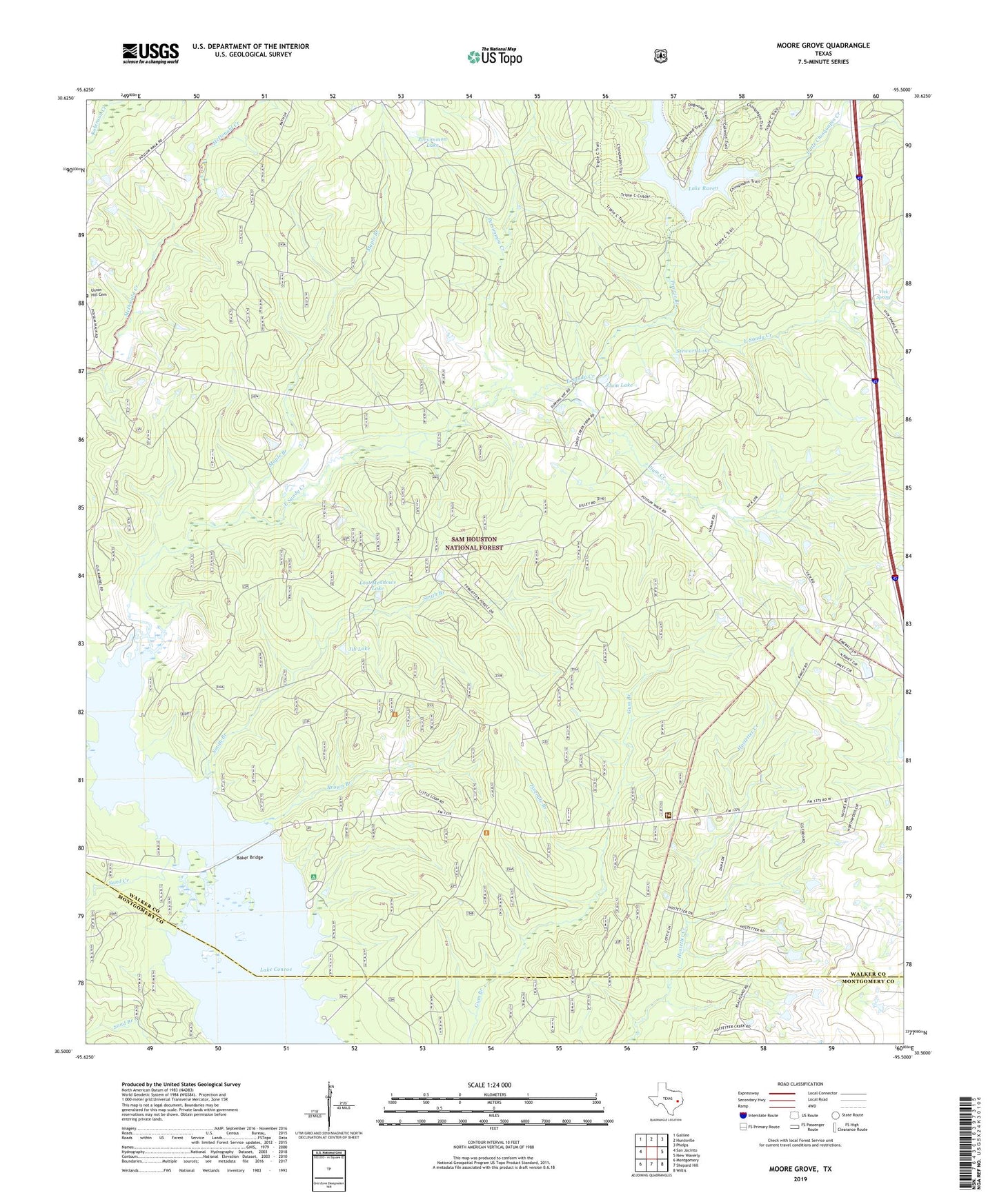
Moore Grove Texas US Topo Map
Couldn't load pickup availability
Also explore the Moore Grove Forest Service Topo of this same quad for updated USFS data
2022 topographic map quadrangle Moore Grove in the state of Texas. Scale: 1:24000. Based on the newly updated USGS 7.5' US Topo map series, this map is in the following counties: Walker, Montgomery. The map contains contour data, water features, and other items you are used to seeing on USGS maps, but also has updated roads and other features. This is the next generation of topographic maps. Printed on high-quality waterproof paper with UV fade-resistant inks.
Quads adjacent to this one:
West: San Jacinto
Northwest: Galilee
North: Huntsville
Northeast: Phelps
East: New Waverly
Southeast: Willis
South: Shepard Hill
Southwest: Montgomery
This map covers the same area as the classic USGS quad with code o30095e5.
Contains the following named places: Baker Bridge, Bath, Bath Lookout, Big Chinquapin Creek, Brown Branch, Cagle Recreation Site, Dell Ranch, East Sandy, East Sandy Creek, Fivemile Branch, Hayman Ranch, Huntsville State Park, Huntsville State Park Dam, Huntsville State Park Lake, Huntsville State Park Trail, Jib Lake, Lake Raven, Little Chinquapin Creek, Lost Meadows Lake, Lost Meadows Ranch, Maple Branch, M-Four Ranch, Moore Grove, Moores Grove Lookout, Old Folks Home, Persimmon Creek, Persimmon Lake, Plum Creek, Plum Lake, Prairie Branch, Randall Ranch, Raven District Ranger Station, Sand Creek, Smith Branch, Stewart Lake, Stewart Ranch, Union Hill Cemetery, Vick Spring