MyTopo
Monticello Texas US Topo Map
Couldn't load pickup availability
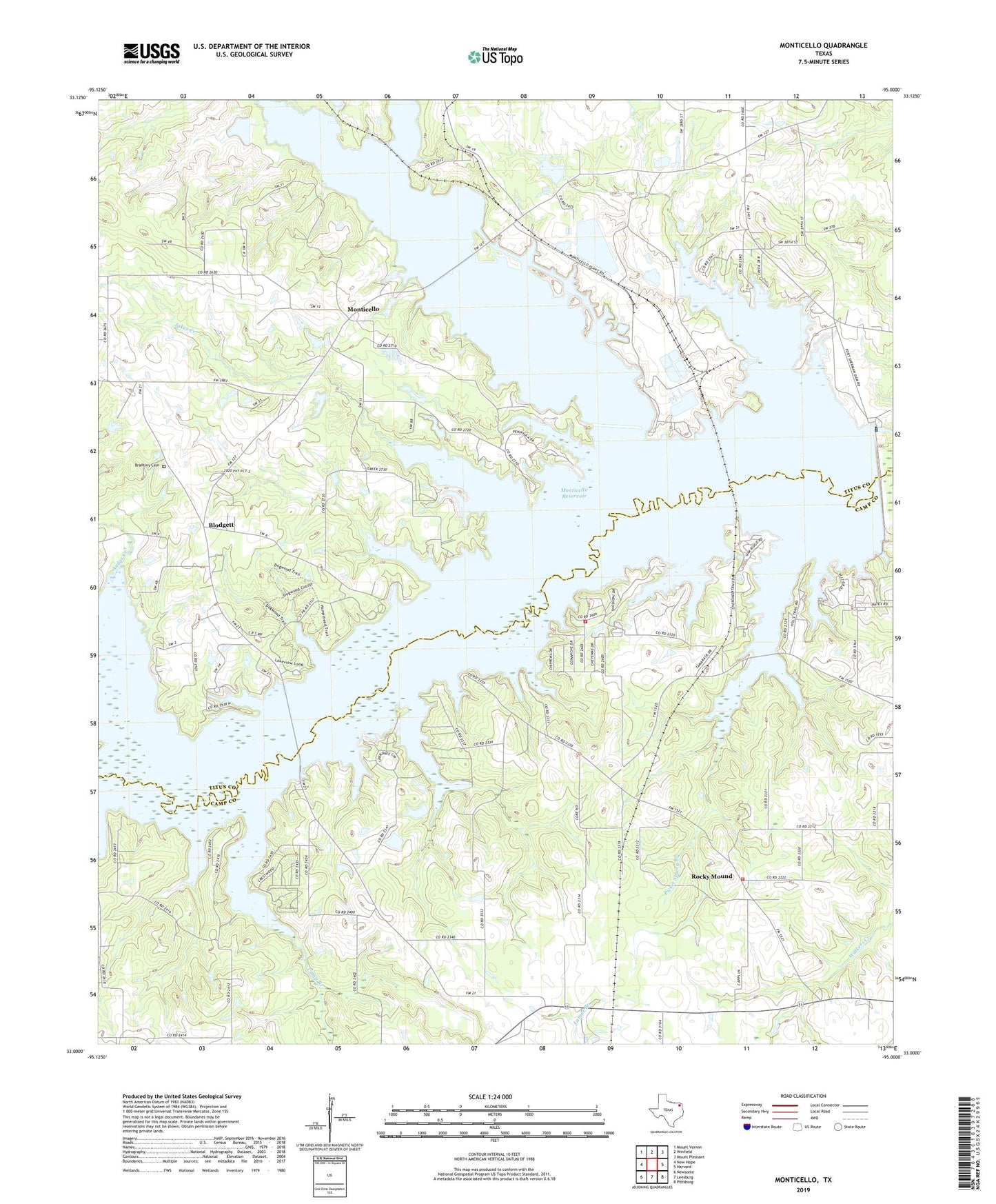
2019 topographic map quadrangle Monticello in the state of Texas. Scale: 1:24000. Based on the newly updated USGS 7.5' US Topo map series, this map is in the following counties: Camp, Titus. The map contains contour data, water features, and other items you are used to seeing on USGS maps, but also has updated roads and other features. This is the next generation of topographic maps. Printed on high-quality waterproof paper with UV fade-resistant inks.
Quads adjacent to this one:
West: New Hope
Northwest: Mount Vernon
North: Winfield
Northeast: Mount Pleasant
East: Harvard
Southeast: Pittsburg
South: Leesburg
Southwest: Newsome
Contains the following named places: Adams Chapel, Blodgett, Blundell Creek, Blundell Creek Church, Brantley Cemetery, Brushy Creek, Camp Branch, Evaes Tabernacle, Fort Sherman Dam, Green Pasture Church, Jakes Creek, John B Stephens Junior Lake A Dam, John B Stephens Junior Lake B Dam, KXAL-FM (Pittsburg), Lake A, Lake B, Lake Bob Sandlin, Lake Bob Sandlin State Park, Lake Bob Sandlin State Park Trail, Lake Monticello, Monticello, Monticello Dam, Monticello Park, Monticello Reservoir, Picket Spring Branch, Rocky Mound, Rocky Mound Church, Rocky Mound Volunteer Fire Department, Smith Creek, Thunderbird Volunteer Fire Department, Town of Rocky Mound