MyTopo
Mount Pleasant Texas US Topo Map
Couldn't load pickup availability
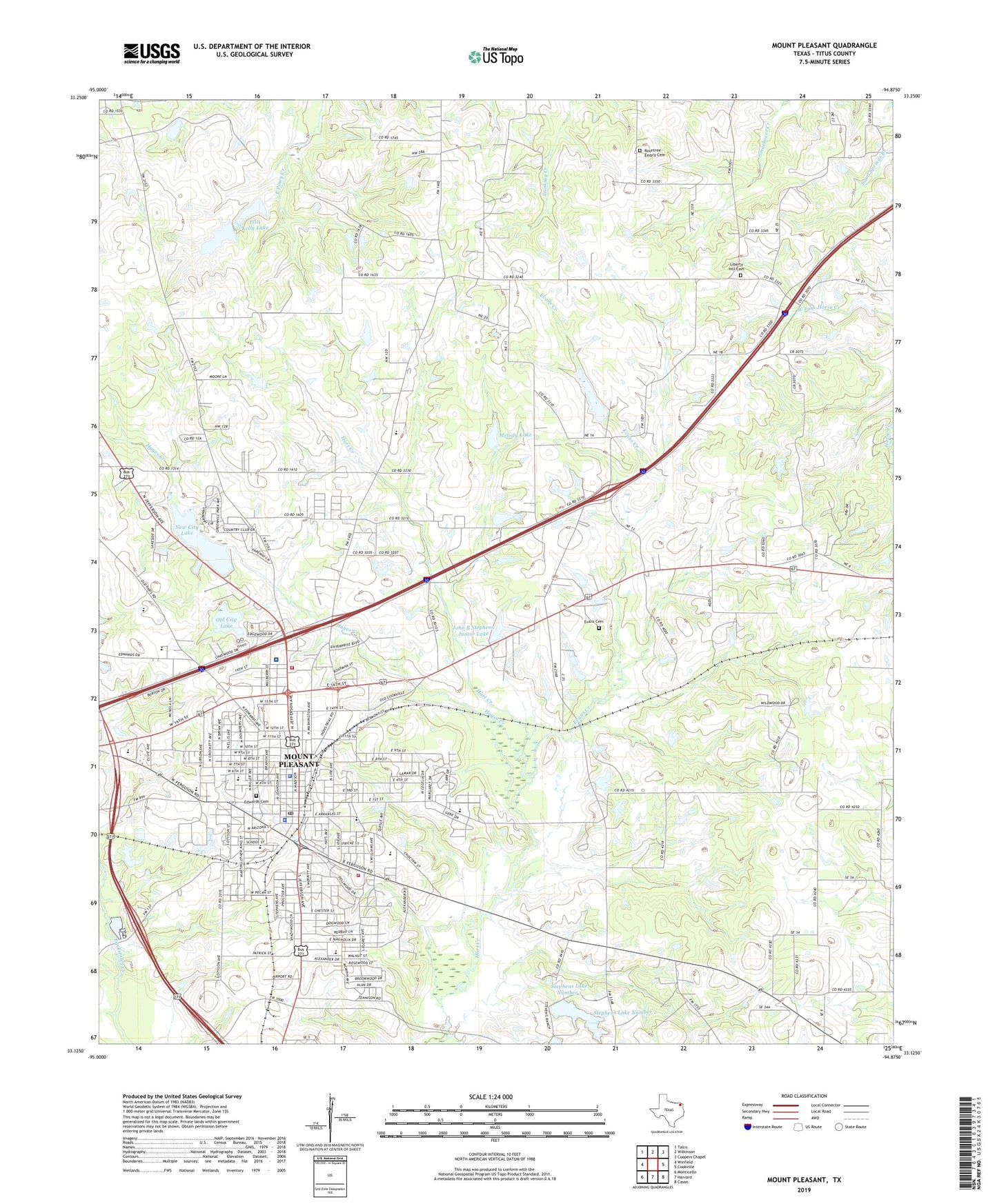
2022 topographic map quadrangle Mount Pleasant in the state of Texas. Scale: 1:24000. Based on the newly updated USGS 7.5' US Topo map series, this map is in the following counties: Titus. The map contains contour data, water features, and other items you are used to seeing on USGS maps, but also has updated roads and other features. This is the next generation of topographic maps. Printed on high-quality waterproof paper with UV fade-resistant inks.
Quads adjacent to this one:
West: Winfield
Northwest: Talco
North: Wilkinson
Northeast: Coopers Chapel
East: Cookville
Southeast: Cason
South: Harvard
Southwest: Monticello
This map covers the same area as the classic USGS quad with code o33094b8.
Contains the following named places: Bethel Church, Bible Christian Assembly of God Church, Center Point, Church of Christ, Church of God of Prophecy, City of Mount Pleasant, Corprew Intermediate School, Corprew School, Dellwood Park, Dellwood Park Assembly of God Church, Dragoo Creek, Edwards Cemetery, Edwards Park, Ellis Kelley Dam, Ellis Kelley Lake, Ellis Kelly Lake, Evans Cemetery, Evans Creek, Fair Park, First Baptist Church, First Presbyterian Church, Gladewater, Green Hill, Harts Bluff School, Hayes Creek, John B Stephens Junior Lake, John B Stephens Junior Lake Dam, Jurney Park, Kieth Park, Liberty Hill, Liberty Hill Cemetery, Liberty Hill Missionary Baptist Church, Melody Lake, Melody Lake Dam, Mount Pleasant, Mount Pleasant Alternative Education School, Mount Pleasant Division, Mount Pleasant Fire Department Central Station, Mount Pleasant High School, Mount Pleasant Independent School District Police Department, Mount Pleasant Municipal Airport, Mount Pleasant Municipal Building, Mount Pleasant Police Department, Mount Pleasant Post Office, Nevils Church, New City Lake, New City Lake Dam, Oak Grove Church, Oaklawn Park, Ocotillo Siding, Old City Lake, Old City Lake Dam, Old Union, Ripley Memorial Baptist Church, Rountree Cemetery, Saint Marks Episcopal Church, Sims Elementary School, Sims School, South Jefferson Baptist Church, South Ward School, Stephens Lake Number 1, Stephens Lake Number 1 Dam, Stephens Lake Number 2, Stephens Lake Number 2 Dam, Texas Parks and Wildlife Department Law Enforcement Division Office, Titus County, Titus County Constable's Office, Titus County Courthouse, Titus County Jail, Titus County Sheriff's Office, Titus Regional Medical Center, Union Hill Church, Vivian Fowler Elementary School, Wallace Junior High School, Wallace Middle School, Washington High School, West Ward School, ZIP Code: 75455