MyTopo
Morris Ranch Texas US Topo Map
Couldn't load pickup availability
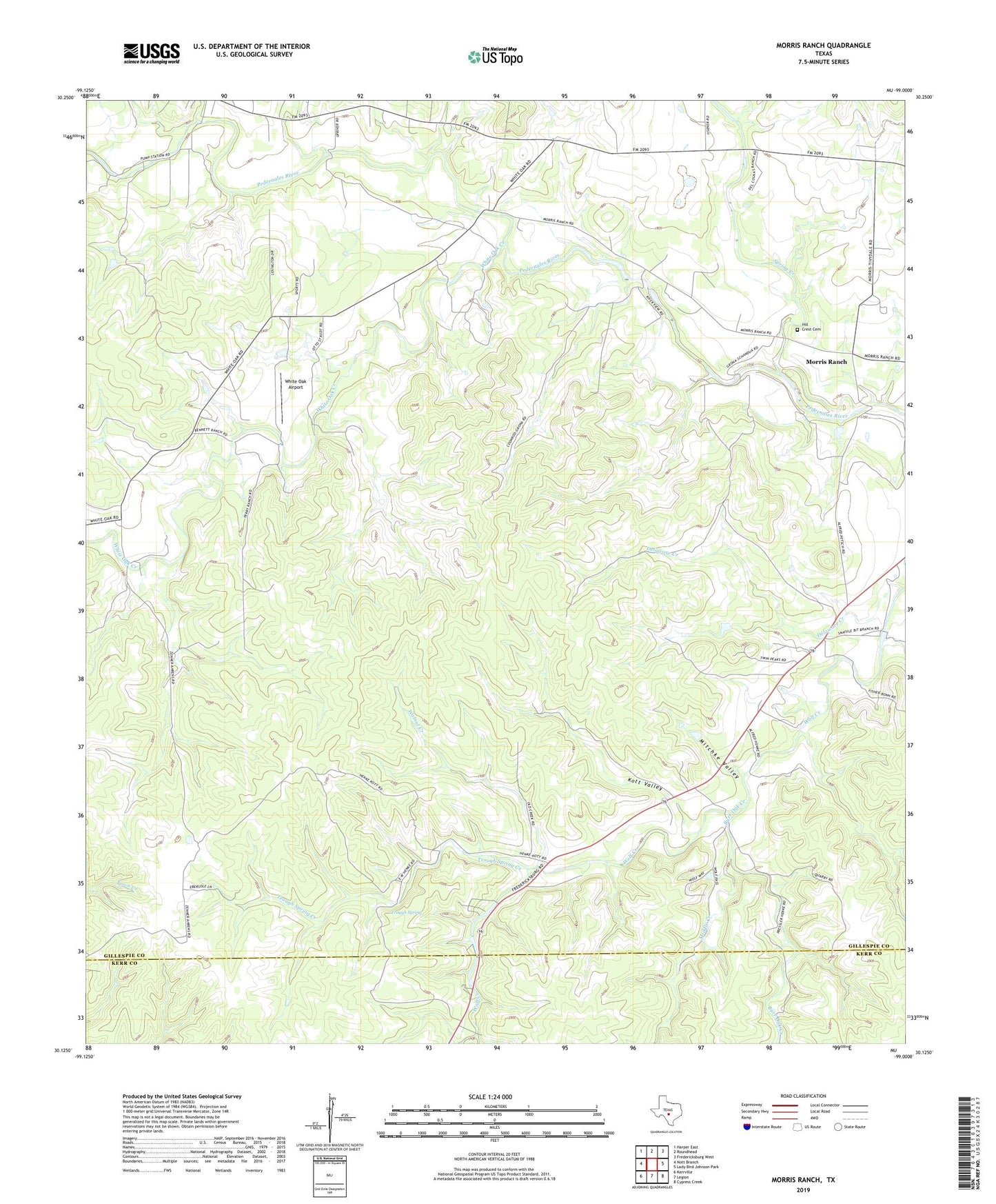
2019 topographic map quadrangle Morris Ranch in the state of Texas. Scale: 1:24000. Based on the newly updated USGS 7.5' US Topo map series, this map is in the following counties: Gillespie, Kerr. The map contains contour data, water features, and other items you are used to seeing on USGS maps, but also has updated roads and other features. This is the next generation of topographic maps. Printed on high-quality waterproof paper with UV fade-resistant inks.
Quads adjacent to this one:
West: Nott Branch
Northwest: Harper East
North: Roundhead
Northeast: Fredericksburg West
East: Lady Bird Johnson Park
Southeast: Cypress Creek
South: Legion
Southwest: Kerrville
Contains the following named places: AK Bar Ranch, Burr Oak Creek, Delaware Creek, Devils Creek, Hill Crest Cemetery, Kott Valley, Middle Creek, Mitchke Valley, Morris Ranch, Morris Ranch Schoolhouse, Spring Creek, Triple H Ranch, Trough Spring, Trough Spring Creek, Walnut Creek, White Oak Airport, White Oak Creek