MyTopo
Mount Livermore Texas US Topo Map
Couldn't load pickup availability
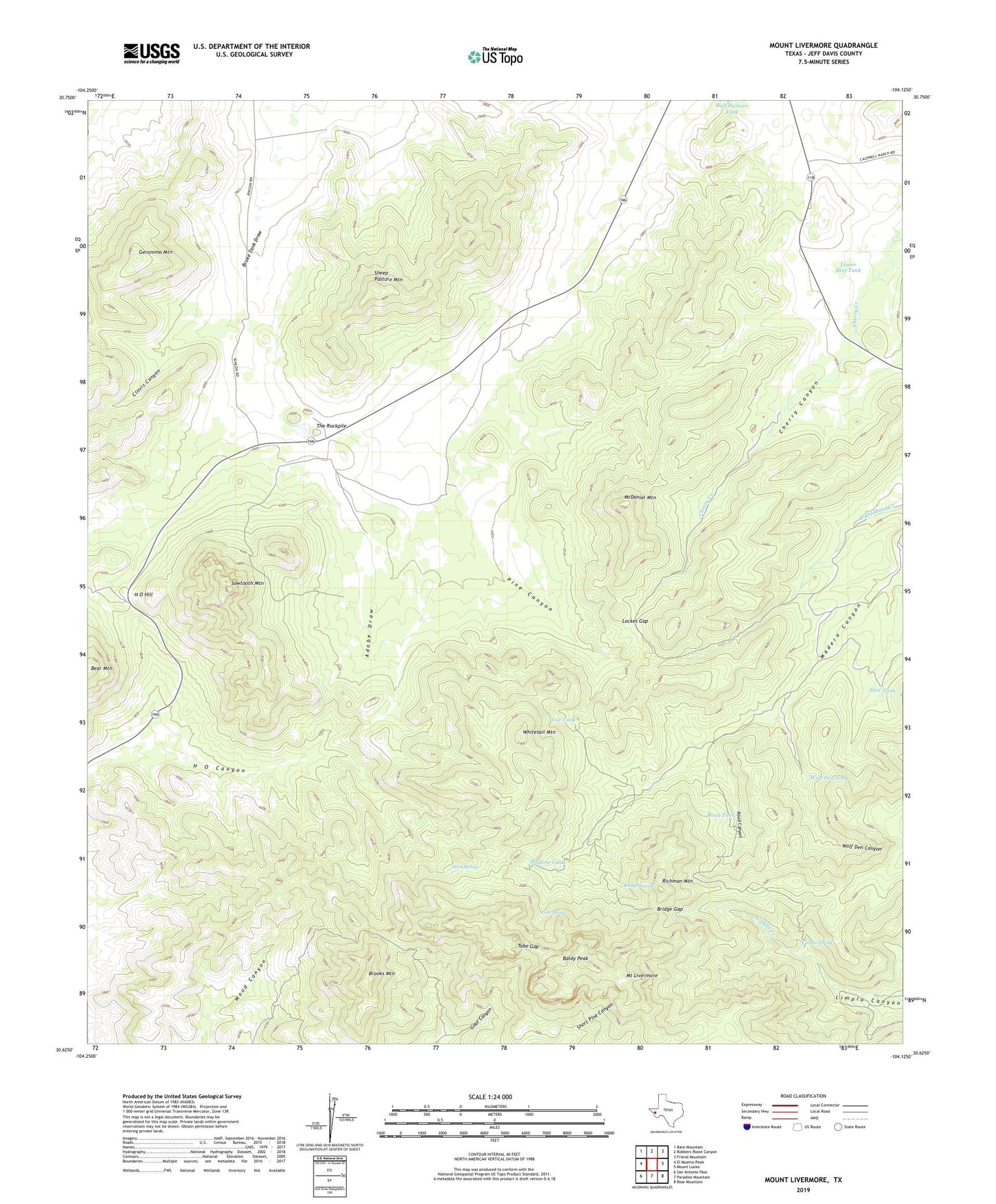
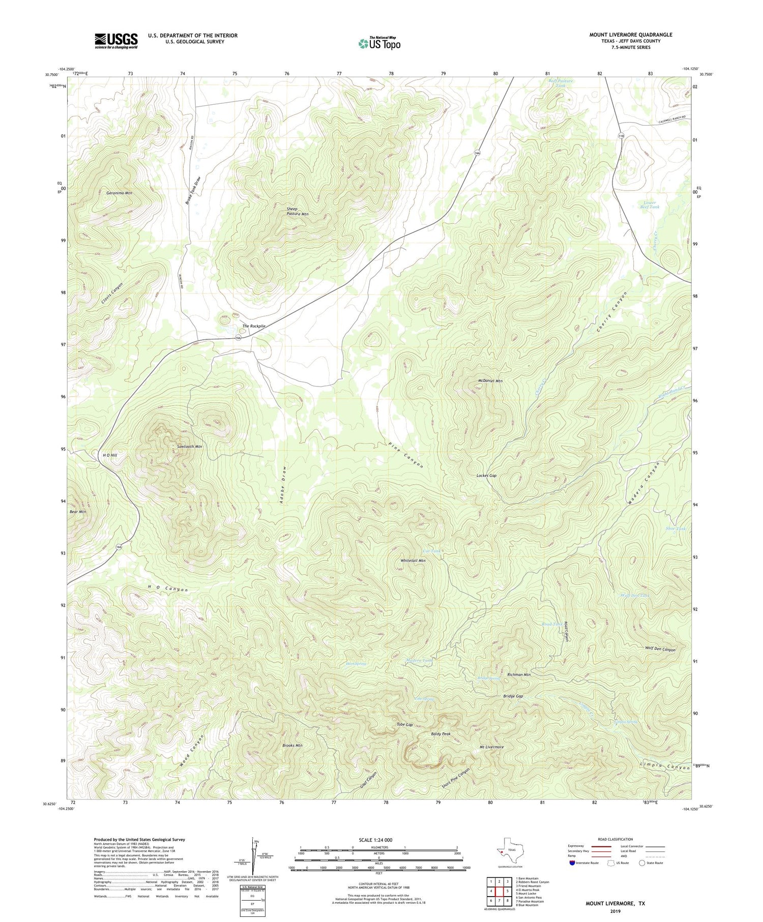
2019 topographic map quadrangle Mount Livermore in the state of Texas. Scale: 1:24000. Based on the newly updated USGS 7.5' US Topo map series, this map is in the following counties: Jeff Davis. The map contains contour data, water features, and other items you are used to seeing on USGS maps, but also has updated roads and other features. This is the next generation of topographic maps. Printed on high-quality waterproof paper with UV fade-resistant inks.
Quads adjacent to this one:
West: El Muerto Peak
Northwest: Bare Mountain
North: Robbers Roost Canyon
Northeast: Friend Mountain
East: Mount Locke
Southeast: Blue Mountain
South: Paradise Mountain
Southwest: San Antonio Pass
Contains the following named places: Baldy Peak, Beef Pasture Tank, Bridge Gap, Bridge Spring, Brooks Mountain, Cat Tank, Clovis Canyon, Davis Mountains Preserve Trail System, Fon Wells, Geronimo Mountain, H O Hill, Horn Spring, House Log Windmill, Jeff Davis County, Limpia Spring, Lockes Gap, Lower Beef Tank, Lower Windmill, Madera Tank, McDaniel Mountain, McDaniel Windmill, Mount Livermore, Pine Canyon, Reynolds Windmill, Richman Mountain, Right Hand Windmill, Road Canyon, Road Tank, Rockpile House Windmill, Sawtooth Mountain, Sawtooth Windmill, Sheep Pasture Mountain, Shoe Tank, The Garden Windmill, The Rockpile, Tobe Gap, Tobe Spring, Upper Madera Windmill, Upper Windmill, Whitetail Mountain, Wolf Den Canyon, Wolf Den Tank