MyTopo
Paradise Mountain Texas US Topo Map
Couldn't load pickup availability
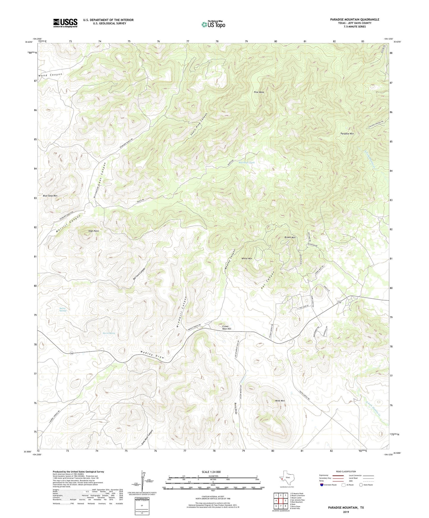
2022 topographic map quadrangle Paradise Mountain in the state of Texas. Scale: 1:24000. Based on the newly updated USGS 7.5' US Topo map series, this map is in the following counties: Jeff Davis. The map contains contour data, water features, and other items you are used to seeing on USGS maps, but also has updated roads and other features. This is the next generation of topographic maps. Printed on high-quality waterproof paper with UV fade-resistant inks.
Quads adjacent to this one:
West: San Antonio Pass
Northwest: El Muerto Peak
North: Mount Livermore
Northeast: Mount Locke
East: Blue Mountain
Southeast: Smith Hills
South: Burro Draw
Southwest: Ryan
This map covers the same area as the classic USGS quad with code o30104e2.
Contains the following named places: Barrel Spring, Barrel Springs, Barrel Springs Ranch, Bat Cave Windmill, Blackeye Tank, Bloys Camp Meeting, Blue Seep Mountain, Box Windmill, Brown Mountain, Crows Nest Hill, Goat Canyon, High Point, Medley Canyon, Mine Mountain, Paradise Mountain, Pet Canyon, Pine Mesa, Short Pine Canyon, White Mountain, Windmill Canyon